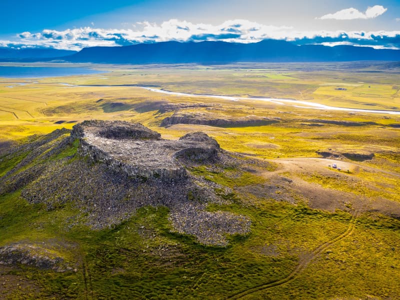
Skip to content

Or try searching by Category and/or Location

History and Culture

In North Iceland, you can travel around the area and get to know historical places, whether it is related to settlement, battles, poets, or the way of life of the past. 

Arctic Henge
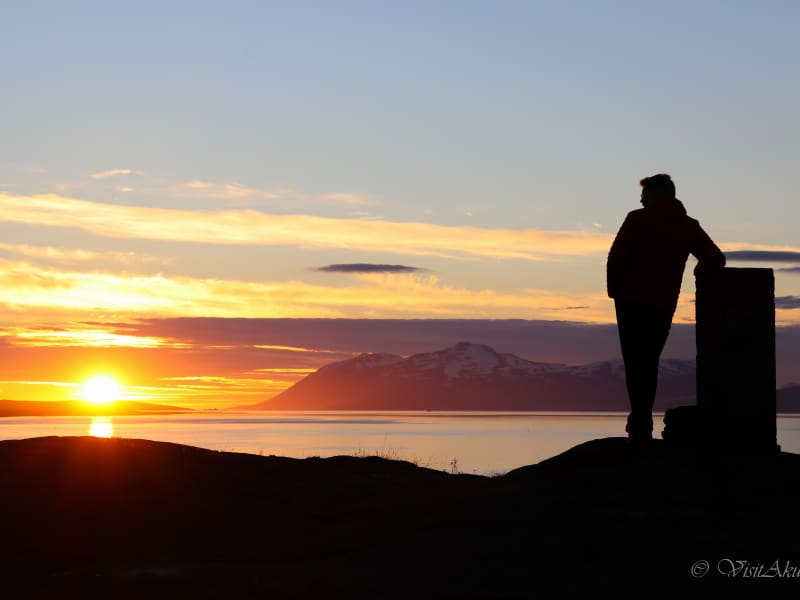
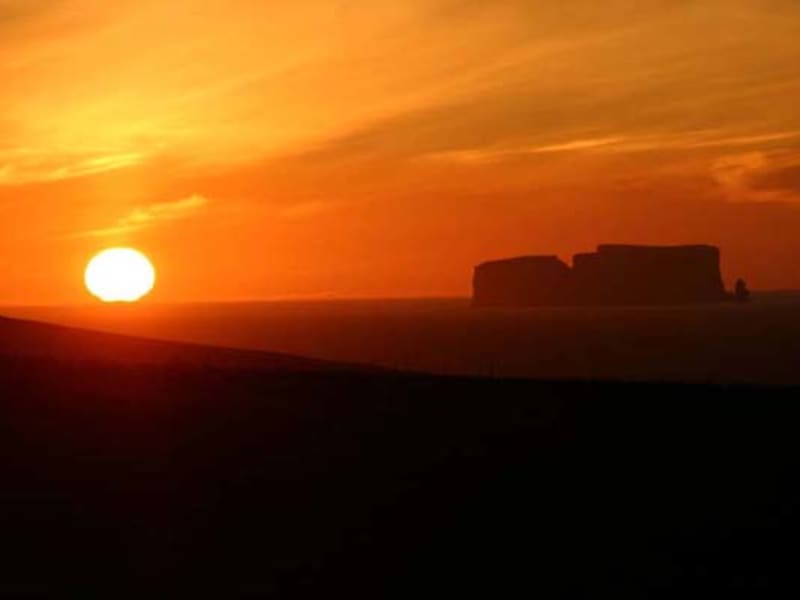
Set in Raufarhöfn, one of the most remote and northernmost villages in Iceland where the Arctic Circle lies just off the coast, the Arctic Henge (Heimskautsgerðið) is under construction. Similar to its ancient predecessor, Stonehenge, the Arctic Henge is like a huge sundial, aiming to capture the sunrays, cast shadows in precise locations and capture the light between aligned gateways. History Heimskautsgerðið (The Arctic-Henge) has it s roots in the innovators Erlingur Thoroddsen’s speculations about the possibility to use endless vistas, where nothing obstructs the horizon, and the midnight sun.  The idea to use the dwarf names from the eddic poem Völuspá (Prophecy of the Seeress) and modernize some aspects of the old world of the Sagas, soon became a part of these speculations.  The first version of the idea is from 1998 but in 2004 it was finalized, with allusions to mythology and folklore, designed to interact with the unique natural light. The designer of the project is Haukur Halldórsson. No one has been able to explain the dwarfs in the Völuspá, apart from Austri (East), Vestri (West), Norðri (North) and Suðri (South), who carry the sky.  By connecting the names of the dwarfs to the season, as for example Bjartur (Bright) Blíður (Sweet) and Svásuður (Gengle) to the summer, it is possible to fit the names of the dwarfs to a yearly circle of 72 weeks.  The year-circle of the dwarfs becomes a kind of almanac, where each dwarf controls a five day period.  All the dwarfs have been given a role and they have all have their own personalities.  This means that the dwarfs can be connected to birthdays and people can connect to their personal dwarf. 
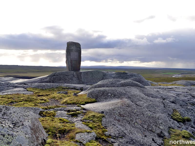
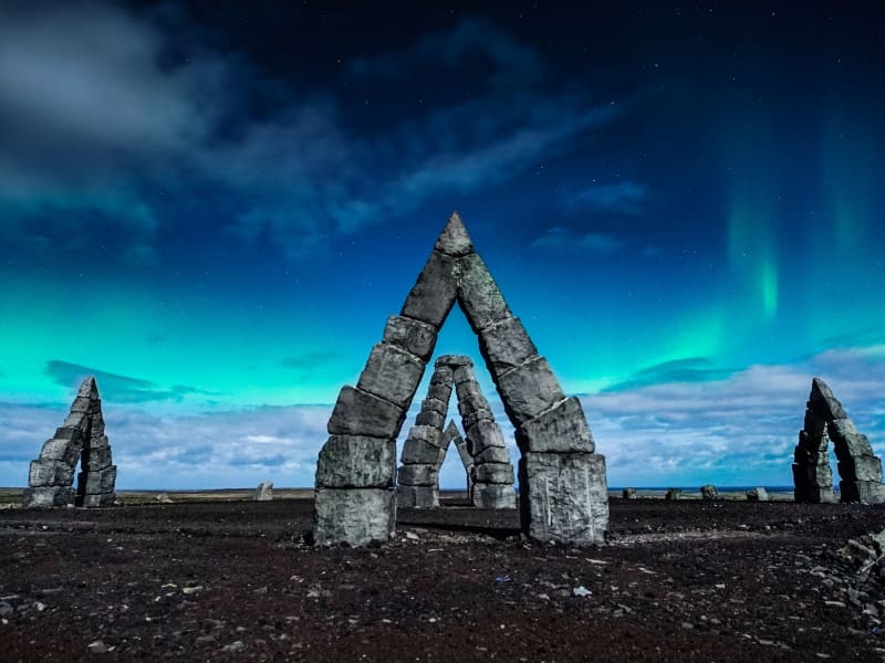
Around this made up world rises the Heimskautsgerði (Arctic-Henge) on the Melrakkaás (Foxhill) in Raufarhöfn.  The Heimskautsgerði is around 50 meters in diameter, with 6 meter high gates that face the main directions.  Between the gates is a high wall with a small opening at the top.  Inside the circle stands 10 meter high column on four pillars. The column will be topped with cut prism-glass that splits up the sunlight unto the primary colors.  The opening between the pillar look towards the main directions, so example the midnight sun can be seen from the south gate through the middle column and the north gate.  The play of light and shadow will follow the time of the day.  The openings on the wall will let in the sunrays so when the building is completed a sundial can be set up. Inside the circle are 68 dwarfs who stand around a circular dwarf trail.  Inside the trail is the polar star pointer, and does exactly what its name says.  There you can also find the throne of the sun that is meant to be a place where the traveler can sit down to have his picture taken.  Also a hall of rays, which is a sort of sanctuary between high columns, with one seat, where the guest can empty his mind an renew his energy.  An altar of fire and water, reminds us of the power of the elements, where events can be performed, for example weddings, oath-taking and so forth.  More information available at www.arctichenge.com Getting There 
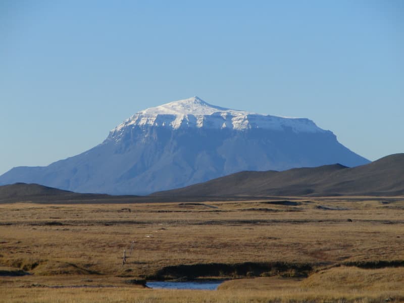
It´s about 130 km from Húsavík, but good roads all the way, so allow 1.5 hrs.Follow the road 85 northeast out of Húsavík, past Ásbyrgi, taking the 874 road junction east just before Kópasker. Once in Raufarhöfn, you can´t miss the stones, looming impressively on the hill above the town. There is a short track to drive up, or you can walk if you prefer. Here is the route.
Bjarg í Miðfirði
Bjarg in Midfjordur, is the farm that belonged to Asdis, the mother of outlaw Grettir Asmundarson - Grettir the Strong, of Grettis Saga fame. Beneath a rock in the hayfield, Asdis buried Gretti´s head, which was presented to her by his killer. There´s now a monument in her honour on site.
Gasir - Medival Trading place
Gásir is a unique place. In no other place in Iceland is it possible to find so many remainings from a trading post from the Middle Ages. Gásir was the main trading post in northern Iceland during the Middle Ages, and the place is mentioned many times in Old Icelandic Sagas from the 13th and 14th centuries. Archaeological digging in the area during the last six years has shown that it was a trading post up to the 16th century, possibly until trading started in Akureyri.
Reynistaður
At Reynistaður in Skagafjörður fjord an entrance hall is all that remains of the large farm that Þóra Björnsdóttir had built after a great fire in 1758. This building is one of the few existing examples of a timber frame from the 18th century. Open daily from 8-18, with no entry fee and no service. 
Hamarsrétt sheep fold
The Hamarsrétt sheep fold has a unique location where it stands on the beach on western Vatnsnes peninsula. The sheep fold is used in the autumn when farmers on the peninsula sort the sheep they herd from the mountain. South of Hamarsrétt is Kallhamar cliff, which name can be translated as "cliff of calling". The cliff got the title as in the old days it was used frequently to send messages or signals to nearby boats. South of the cliff one can find the remnants of the fishermen's camp. North of the fold you will find the local community center Hamarsbúð. 
Möðrudalur
At an altitude of 469 m, Möðrudalur farm lies higher than any other Icelandic farm. The remarkable, tiny church was built by the farmer himself, Jón Stefánsson, in 1949. The tourist services here operate year-round. Various trails have been marked through the area, which prides itself on wide panoramas and amazing silence. The majestic Mount Herðubreið, looming in the near distance, has long been referred to as the Queen of Icelandic Mountains, but its image was further cultivated in the last century by a self-made painter from Möðrudalur farm, Stefán Jónsson (Stórval).  
Þingeyrakirkja church
Þingeyrar was, in past times, one of the most famous estates in Húnaþing and also the site of a church. Now, the Þingeyrakirkja church commands one of the widest and most beautiful panoramic views in the county. It is said that no estate was as big as or endowed with such elegant buildings as Þingeyrar, which is probably not surprising as it was home to chieftains and the elite for many centuries. Þingeyrakirkja church was built of stone and consecrated in 1877. Þingeyrar was also the site of the Iceland’s first monastery, founded in 1133.
First settlers
 A statue of Helgi magri (Helgi the lean)and Þórunn hyrna (Þórunn the horned), the first settlers of thearea, about the year 890, stands on the Hamarkot Rocks on the streetBrekkugata near the police station.  The story tells that the parents ofHelgi handed him over for fostering into the Hebrides, and when they came theretwo winters afterwards, he was so starved that they did not know him; theybrought him away with them and called him Helgi the lean. He was brought up inIreland, and when he was grown up, he married Þórunn hyrna (Þórunn the horned).They moved to Iceland with their children and settled the whole of Eyjafjörður.Helgi magri handed out parts of the settlement, which was very big, to hischildren and kin but selected and built his own farm at a site which henamed Kristnes (Christ Cape) some 12 km south of Akureyri, a place where hedwelt during the remainder of his life. Helgi believed in Christ and thereforegave this name to his dwelling.Þórunn hyrna, was thedaughter of Ketill flatnefur. Ketill Björnsson, nicknamed Flatnose (Flatnefur), whowas a chieftain of the Isles of the 9th century. All his childrensettled big parts of Iceland, Þórunn hyrna in Eyjafjörður, Auður djúpúðga, at Hvammur in West-Iceland.Her brother, Helgi bjóla, settled Kjalarnes and her other brother, Björnaustræni, settled Snæfellsnes and lived in Bjarnarhöfn.The statue, which was made by Jónas S. Jakobsson in 1956, is located on top ofHamarkotsklappir behind the Police station (Lögreglustöðin). About 5-10min. walk from town center.  Two prominent streets in Akureyri arenamed after these settlers - Helgamagrastræti street and Þórunnarstræti streetand the kindergarten Hólmasól is named after Helgi and Þórunn first child(daughter) Next to the statue, one can find an old view-dial. On the view-dial iswritten 1949 - Ferðafélag Akureyrar, but these view-dials show the names of thesurrounding mountains. 
Borgarvirki
Borgarvirki is a 10-15 metre high ridge of columnar rock. This phenomenon is a volcanic plug, and there is speculation as to whether it was, in ancient times, a district fortress and even, perhaps, a battleground.From Borgarvirki there is a wide panoramic view over a large part of the region and a viewfinder is in place to help locate some of the important landmarks.This is truly a unique natural phenomenon, but one which has also seen some improvements by the hand of man in bygone days.
Hearts of Akureyri
In Akureyri, stopping at a red light is much more pleasant than elsewhere. The red lights are heart-shaped! The heart in the traffic lights have caught the attention of those visiting Akureyri and the hearts of the inhabitants. The hearts lit up all over town as a consequence of the finance crash in Iceland in year 2008, when there was a need for some positive thinking and to put emphasis on what really matters. Since then the red hearts in the traffic lights are visible as well as plenty of red hearts made of the flower “forget me not” decorating windows, cars and signs throughout the town. A perfect place for a selfie with the red traffic light always glowing, is down by the harbor in the city center close to Hof Cultural house. Use the hashtag #heartsofakureyri 
Akureyri Old Town
The old town of Akureyri brings you back to the beginning of the town. The area is located just a short stroll from town centre, towards the south. The area is a monument to the town‘s history and culture. Many of the town oldest houses have been preserved and the original street planning has been maintained. Informative signposts guide visitors about the history of a different era. On this walk, you see the old Theatre, the old Primary School and the Old Hospital built in 1827, the firsttwo-storied house built in Iceland and the oldest building in Akureyri, Laxdalshús, built in 1795. The name of Akureyri dates back to the 15th century, but it was not until 1778 that the first dwelling was built on the site. The oldest building that still remains was built in 1795, called Laxdalshús. The houses and style of architecture are what draws the attention in this area. Around what used to be the main harbour but now home to the local sailing club Nökkvi you find many of the original buildings that kicked off this small harbour town. As time passed and the population grew, the hills behind the town developed as there was only one way to go – up!Many of the buildings feature coting of corrugated iron. Traditionally this was used as a roofing material and for building farming sheds but in Iceland, it was commonly used as an external covering on walls to protect the woodwork. Anothermethod of shielding houses that is quite special for Akureyri, as it is rarely found in other places in Iceland, is the use of pressed iron plates, like tiles. These were imported from the US in the 1930s, and many of the oldest houses still wear this type of coating with beautiful colours.  For more information about the old town and the houses see our historical signboards.  https://www.visitakureyri.is/en/see-and-do/culture/skilti-baejarins 
Orbis et Globus
The artwork "Orbis et Globus" was inaugurated on the Arctic Circle in Grímsey Island in the fall of 2017. It is a 3-meter sphere which is meant to be moved around the north end of the island in accordance with the movement of the Arctic Circle.Before the 2018 Summer Solstice Festival in Grímsey, the artwork was moved about 130 meters to the south, and this year it will be moved approx. 69 meters.The artwork is a symbol and a landmark for the Arctic Circle and has attracted attention from all over the world. The aim of the project was to draw attention to this northern most part of Iceland and to increase attractiveness of the island for tourists. Already, this has happened with great success. The inhabitants of Grímsey are less than 100 people and it is of the utmost importance to strengthen residence there all year round.Most visitors that come to Grímsey now, aim to reach "the sphere of the north". They want to see and touch the artwork and while doing so step beyond the Arctic Circle.The walk from the harbour to the artwork is about 3.7 km and from the airport about 2.5 km. One must expect about 3 hours walk forth and back. It is recommended to stay overnight as the traditional stop of the ferry and the air plain is almost too short to enjoy and see the most essential things on the island. Things one should try to do while on the island is to walk around in the little village, drop by the Fiske-monument and read the sign-boards, visit the restaurant Krían (Arctic tern) and/or the smallest Café in Iceland at the Guesthouse Gullsól. Take a walk to the lighthouse at the islands southernmost point and walk along the south-west shore of the island and look at the beautiful basalt columns and old fishing huts. On that route one can find the "Century stones" which display the position of the arctic circle Anno 1717, 1817 and 1917. During the birding season (end April till beginning August) one must also calculate some time for bird-watching as that's one of the phenomenal things experiencing in Grímsey.Orbis et Globus was designed by the artists Kristinn E. Hrafnsson in collaboration with Studio Grandi. It was selected to be the new landmark for the Arctic Circle in a competition for such an artwork held in 2013.
Illugastaðir
At Illugastaðir on Vatnsnes peninsula you find one of the best seal watching place in Iceland. There are good facilities and service for travellers. Good walking path is next to the ocean and a trail to the sealwatching place. There you also find nice sealwatching hut to stay in when the weather is bad. The seals stays at Illugastaðir most days of the year, laying in rocks or swimming in the ocean close to the shore. Good camping site is at Illugastaðir and perfect place for walking in the nature. All kind of bird do nest at Illugastaðir, and large numbers of Arctic tern and eider ducks. Attention! Because of the large number of eider ducks that nest at Illugastaðir in the spring, the area is closed for all visitors from 1st of May until 20 June every year.
Hólar Cathedral
Hólar Cathedral is the oldest stone church in Iceland, constructed in 1763. The church is built with red sandstone from the mountain Hólabyrða. A number of historically important items are on display at the church. The church tower is 27m long and stands beside the church. It was constructed on the 400-year anniversary of the death of the last Catholic Bishop of Iceland, Jón Arason.
Skalar in Langanes peninsula
What remains of the village of Skálar are remnants of a life that used to be: a thriving community whose livelihood depended on the sea. Changing conditions in the fishing industry and transportation, the explosions of maritime mines, and other factor led to the abandonment of the settlement in the 1950s. Interwined with the village´s history are the factors that made Skálar an appealing place to live, its role in World War II, changes in transportation, the lives of individual families, and much more. Some of the ruins have been marked with a number and name.
Chapel at Gröf
Grafarkirkja is a small chapel built by Gísli Þorláksson, bishop of Hólar in the late 17th century. The church is believed to be the work of a well-known wood carver of the time, Guðmundur Guðmundsson, whose baroque carvings can be seen on the altar and verge boards. The Church is closed to visitors. Grafarkirkja is a small chapel built by Gísli Þorláksson, bishop of Hólar in the late 17th century. The church is believed to be the work of a well-known wood carver of the time, Guðmundur Guðmundsson, whose baroque carvings can be seen on the altar and verge boards. The church was deconsecrated in 1765. The National Museum of Iceland had it entirely rebuilt in its original form in 1953. The graveyard is circular, an ancient form. The farm buildings at Gröf formerly stood on a hill north of the church. The church was built in 1884, and was the last turf church built in the old style. It is one of six churches still standing, which are preserved as historical monuments. The church is maintained by the National Museum but also serves as a parish church. The church was built by the carpenter Páll Pálsson. The lock and hinges of the church door were made by Þorsteinn Gissurarson, called „tool”, who was a well-known blacksmith. The water tub he used to cool hot iron can be seen south of the churchyard. 
Kálfshamarsvík
Kálfshamarsvík is a small cove in the northern part of Skagi, with unusual, beautifully formed sea cliffs of columnar rock, created about 2 million years ago. At the beginning of the 20th century, fishing boats plied the waters and there was a small community of about 100 inhabitants at Kálfshamarsvík. However, by around 1940 the village had become deserted.
Drangey
The rocky island Drangey in the middle of Skagafjordur is a flat topped mass of tuff, rising almost 200 meters out of the ocean. The cliffs serve as nesting sites for around million sea birds and have been used throughout Iceland´s history for egg collection and bird netting. Grettis Saga recounts that both Grettir and his brother Illugi lived on Drangey, for three years and were slain there. The island can only be ascended at one spot.During summer, Drangey Tours offers boat trips to the island.
Þrístapar
Þrístapar is a historic site, where the last execution of a convicted felon took place in 1830. Agnes Magnúsdóttir and Friðrik Sigurðsson were sentenced to death for two murders, and their story and the story of this execution is told on signs and monuments on the site.   You can listen to a story from this event at the Arctic Coast Way site: https://www.arcticcoastway.is/en/stories/vatnsnes-1