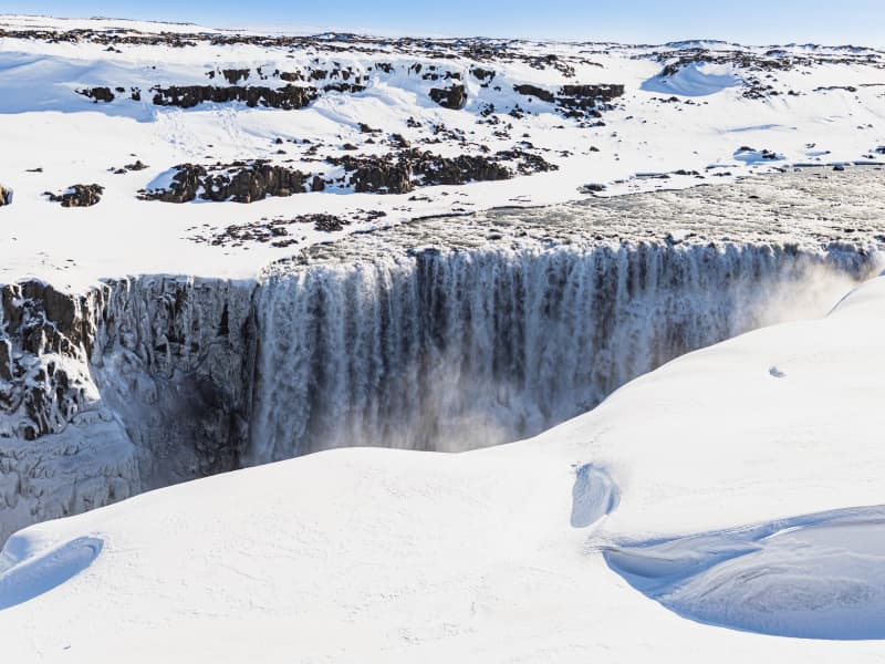
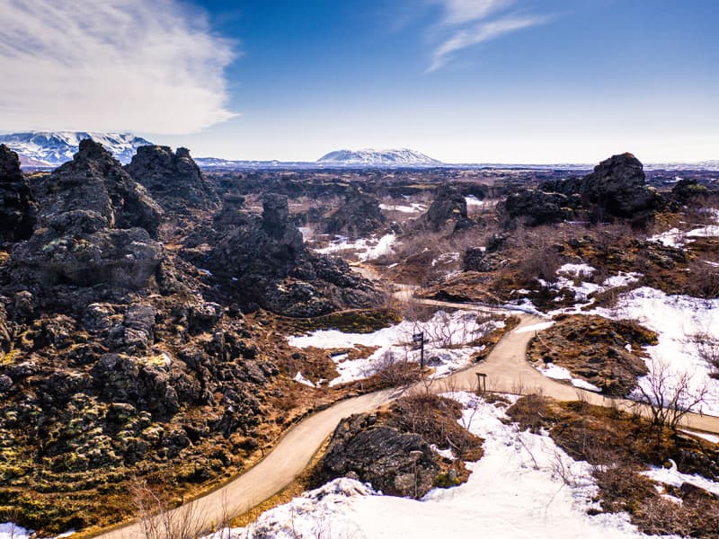
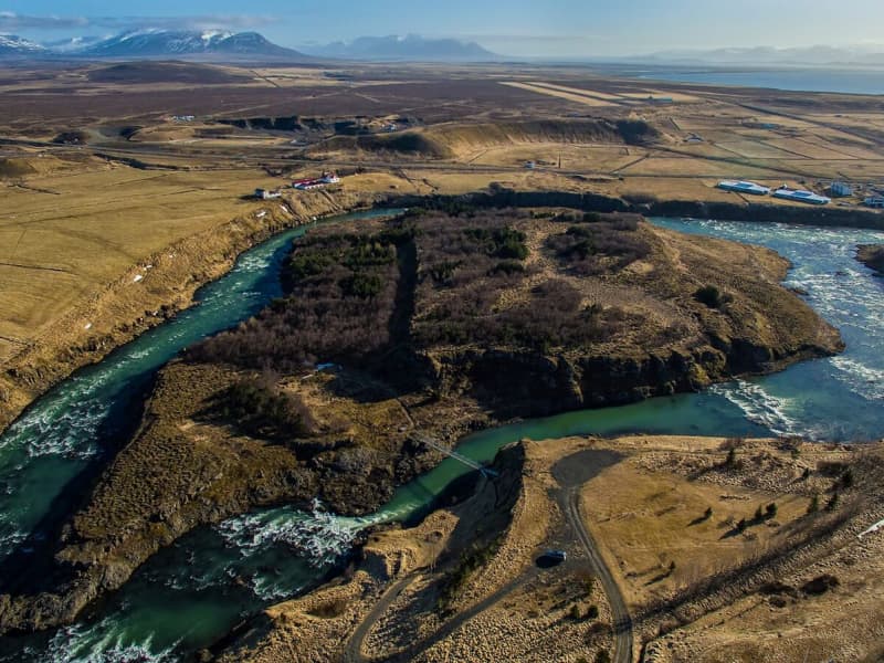
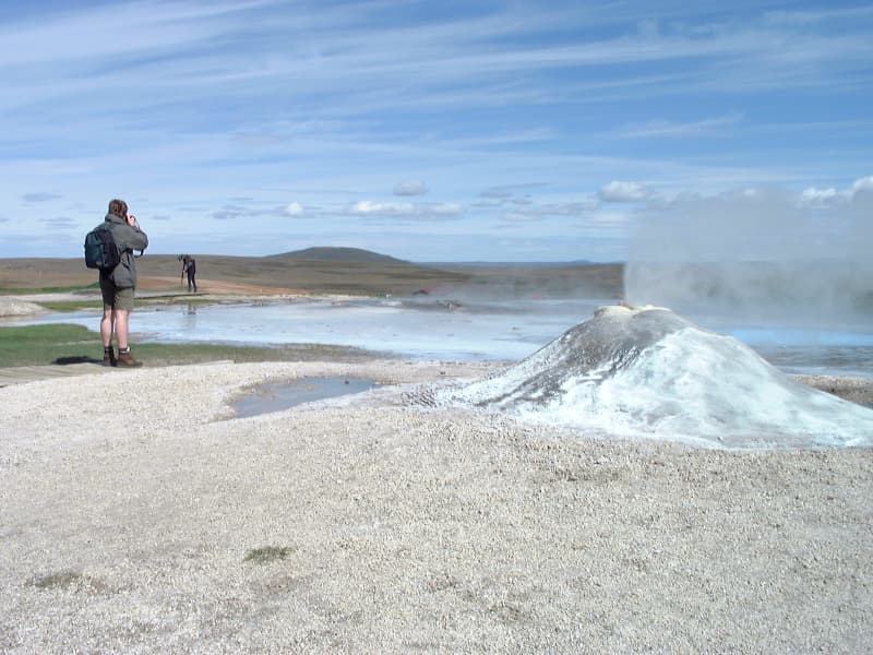
Skip to content

Or try searching by Category and/or Location

Nature reserves in North Iceland

National parks and protected areas, guarantee our and future generations the right to enjoy untouched nature.

Hverfjall
Hverfjall has a large, circular explosion crater, about 140 metres deep and with a diameter of 1,000 metres. Hverfjall is one of Iceland's most beautiful and symmetrical explosion craters, besides being one of the largest of its kind in the world. It is estimated that the crater was created during a volcanic explosion and its likely around 2800 - 2900 years old.
Spákonufellshöfði Headland
Spákonufellshöfði headland is popular among those interested in walking and other outdoor recreations, and is a short way from the harbour in Skagaströnd. Marked footpaths have been laid out and signboards erected telling the visitor about the area’s flora and fauna. On a bright, clear summer evening, one can witness the setting of the midnight sun as it dips to touch the horizon in the north. Indeed, the inhabitants of the area make use of the headland all year round and enjoy all that it has to offer.
Hrútey
  Hrútey Island is the real feather in the cap of Blönduós town, which is almost encircled by the river Blanda. Hrútey is blessed with a wide variety of vegetation and birdlife is abundant, being the habitat of geese and many other species. It is easily accessible and lies just off Highway 1. There is a good parking area by the river bank and a trusty pedestrian bridge over to the island. Hrútey is an excellent place for outdoor exercise, or just to stop and take a break. There are good footpaths and a clearing with benches and picnic tables.
Skútustaðagígar
Skútustaðagígar pseudo craters were formed by gas explosions, when boiling lava flowed over the wetlands. The craters are a popular site for birdwatchers and are protected as a natural wetland conservation area.
Dimmuborgir
Dimmuborgir or Dark Cities is an area of randomly strewn lava rocks and cliffs, surrounded by vegetation such as low bushes and plants. Dimmuborgir is a place of surprises with its myriad forms and images, small caves and towering volcanic rock, pierced by natural apertures. The most famous of these formations is the cave "The Church", aptly named for its dome-like ceiling. It is not only in summer that Dimmuborgir exerts its charm; a winter visit is also an invigorating experience which must include popping in to see the Yule Lads (Santas) who have settled there and made it their home.
Glerárdalur Valley
A nice walk leads from the mouth of the valley Glerárdalur to the bottom of it and ends by the mountain cabin named Lambi, some 11 km into the valley. 
Dettifoss Waterfall
The Dettifoss waterfall is the most powerful waterfall in Europe, 200 cubic meters of water per second plunge over the edge. Dettifoss is 45 m high and 100m wide. A nice hiking trail, 34km, goes along the canyon from Dettifoss to Asbyrgi. Camping is possible in Vesturdalur. Road 864 goes from road 85 past Dettifoss on the east side towards road 1. This is a gravel road and driving speed depends on road conditions each time. Road 864 is closed during wintertime due to snow or wet conditions (muddy road) and does not open until early summer (end of May). Road 862 is on the west side of the waterfall. This road is paved but is not in winter service from January until the beginning of April. Dettifoss Waterfall is part of the Diamond Circle. 
Krossanesborgir
Krossanesborgir is a nature reserve north of Akureyri, that allows you for a soft walk by the sea, and chances for bird watching in summer. Popular among locals for berry picking in autumn.
Jökulsárgljúfur Canyon
This dramatic canyon, Jökulsárgljúfur, was formed by the actions of water, fire and ice. Enormous, catastrophic glacial bursts are believed to have carved out the deep ravines and rocky basins, the most famous of which is Ásbyrgi.The Hljóðaklettar outcrops are the cores of ancient volcanoes, revealed when the river swept away all the loose volcanic material.The waterfalls on the River Jökulsá á Fjöllum, Selfoss, Dettifoss, Hafragilsfoss and Réttarfoss are powerful and impressive.The Hólmatungur district is an area of contrasts: crystal clear streams and bubbling brooks cross the land before emptying into the raging, chocolate-coloured torrent. A delicate balance of flora and fauna thrives under the protection of cliffs and scree slopes.
Hveravellir
The “hub” of the Kjolur Route, is a geothermal area of fumaroles, and multicoloured hot pools. There are two mountain huts with kitchen facilities and a nice hot pool just outside the hut.
Mývatn Nature Reserve
Lake Mývatn is a veritable paradise for birdwatchers and there is a highly diverse birdlife to be found both on the waters of the lake itself and on its shores. Many waders and marsh dwellers make their home there, but Mývatn is probably best known for its unique duck species composition. During the summer months there are more species of duck gathered in and around its waters than anywhere else on the planet. Mývatn and its wetlands are protected as a nature reserve (The Mývatn-Laxá Nature Conservation Area). It is registered as one of the internationally important wetlands, along with the Laxá river which flows out of the lake.
Vatnajökull National Park - north part
Vatnajökull National Park is vast in size and covers more than 13% of Iceland. Despite a large part of the national park being underneath the icecap of the glacier Vatnajökull its landscape is diverse, predominantly due to the interplay of volcanic activity and glaciers. Jökulsárgljúfur is an area that takes its name from a canyon carved out by river Jökulsá á Fjöllum. Within this area is Ásbyrgi; surrounded by horseshoe-shaped cliffs and also the location of Ásbyrgi visitor centre and a large camp site. Also within Jökulsárgljúfur are waterfall Dettifoss and crater plugs Hljóðaklettar, both a must see for every visitor in the north. Central volcano Askja and highland oasis Herðubreiðarlindir are further up in the highlands. To get there requires a 4x4 transport. They are best accessed by road 901 and then F905. Two small fords need to be crossed on this way. Alternative route is through road F88 but then two fords that need extreme caution need to be crossed. More information about the National park is at the webpage: www.vatnajokullnationalpark.is