In the highlands of Iceland, mountain huts and cabins are the available option.
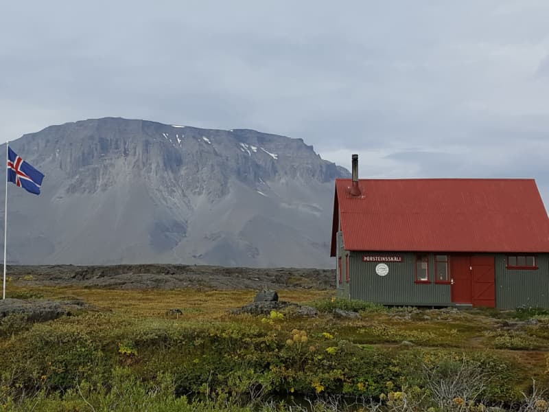
Þorsteinsskáli - Akureyri Touring Association
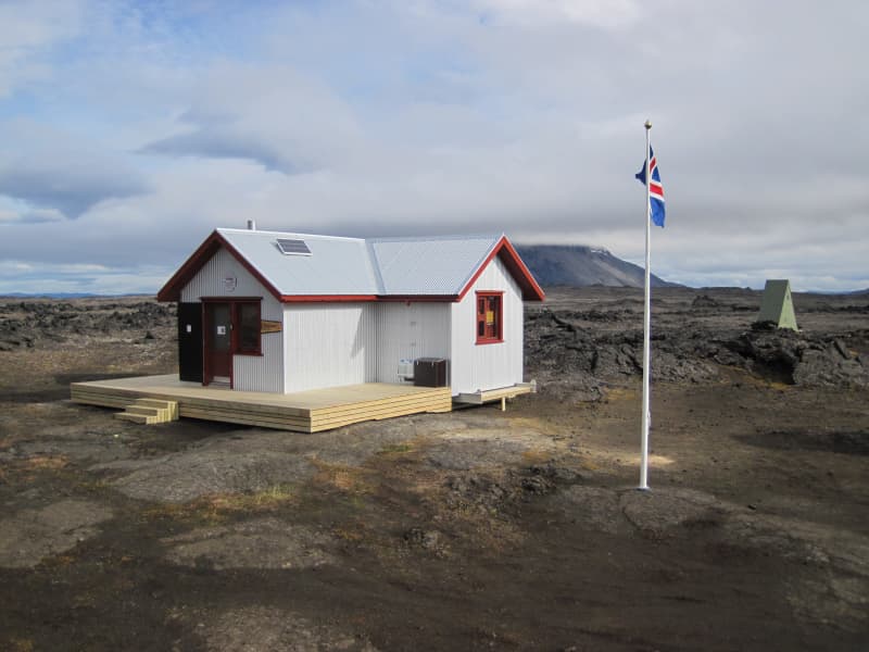
Thorsteinsskáli hut is located in the Herðubreiðarlindir oasis, approx. 4 km E of the beautiful Herðubreið table mountain. The hut was built in 1958-60 and sleeps 30. It has gas for cooking and kerosene stove for heating. There is a sanitary house with WC and a gas-operated shower, open during the summer months, when there are hut wardens in the area. There is a camping ground by the hut. The hut is closed during the winter months. The mountain road F88 from the ring road W of Jökulsá á Fjöllum river to the Askja caldera passes close by.
GPS: N65°11,56 W16°13,39 Herðubreiðarlindir. Heating, gas for cooking, WC.
Reservations and enquiries: Club office of FFA: e-mail: ffa@ffa.is or phone number: +354 462 2720.See website: https://www.ffa.is/en/huts/huts
View
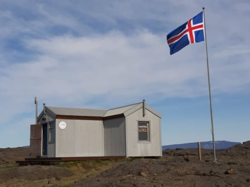
Lambi - Ferðafél. Akureyrar/ITA
GPS: N65°34,88 W18°17,77
Lambi hut is located in Glerárdalur valley, SW from the Akureyri town, approx. 720 m above sea level. The hut was built in 2014 and sleeps 16. The hut has a kerosene-operated stove for cooking and for the heating of the hut. Drinking water can be obtained from a small stream approx. 100 m S from the hut.
There is a marked walking route, 10-11 km, from a car park at the rubbish tip of Akureyri town to the hut. There is a great variety of interesting mountain routes in the Glerárdalur area, starting from the hut, see the walking route map of Glerárdalur.
Reservations and enquiries: Club office of FFA: e-mail: ffa@ffa.is or phone number: +354 462 2720.See website: https://www.ffa.is/en/huts/huts
View
Hveravellir
Hveravellir is one of Iceland’s most popular Oasis in the highlands whether your drive hike or ride the Icelandic horse. The area offers various hiking trails through the wonders of the lava field or nearby spectacular mountain slope. And for those in need of recharging and relaxing just a simple chill in the nature pool followed by a cup of hot chocolate and a slice of cake in the Internet Café might be just the thing.
View
Laugafell - Ferðafél. Akureyrar/ITA
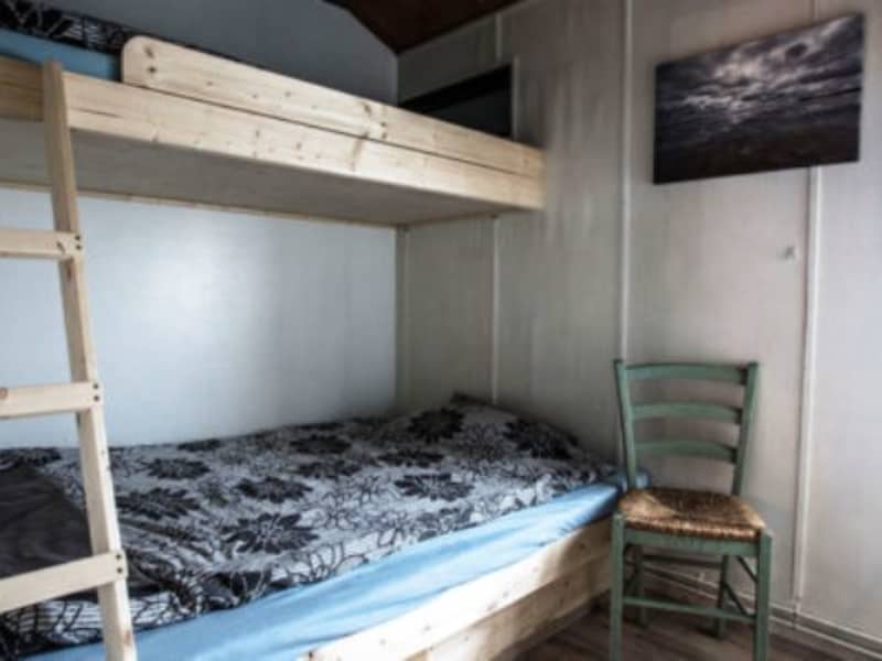
Laugafell hut is located on the high plateau of North Icleand, 15 km NE of Hofsjökull glacier and 20 km SW from the end of Eyjafjarðardalur valley. The old hut was built in 1948-50 and the sanitary house with sleeping accommodation was built in 1994-98. The accommodation in the huts is a sleeping bag accommodation.Guests must bring their own sleeping bags. The old hut sleeps 20 and the sleeping loft in the sanitary house sleeps 12. The houses are heated all year round with geothermally hot water. There is gas for cooking. The sanitary househas WC facilities and changing cubicles for the adjacent swimming pool. The camping place is beside the huts. There is a warden at Laugafell in July, August and the beginning of September. The huts are locked in the winter but the toilets and changing facilities are open all year round. The Laugafell area is conveniently located for 4-wheel drive traffic on the northern high ground of Iceland as tracks lead from Laugafell to Eyjafjörður (F821), Skagafjörður (F752), Bárðardalur (F881 and F26) and the South via Sprengisandur (F752 and (F26).
Phone number (in summer): (+354-) 833-5697.
Reservations and enquiries: Club office of FFA: e-mail: ffa@ffa.is or phone number: +354 462 2720.See website: https://www.ffa.is/en/huts/huts
GPS: N65°01,63 W18°19,95Heating, gas for cooking, wc.
View
Bræðrafell - Ferðafél. Akureyrar/ITA
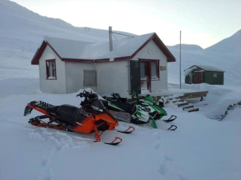
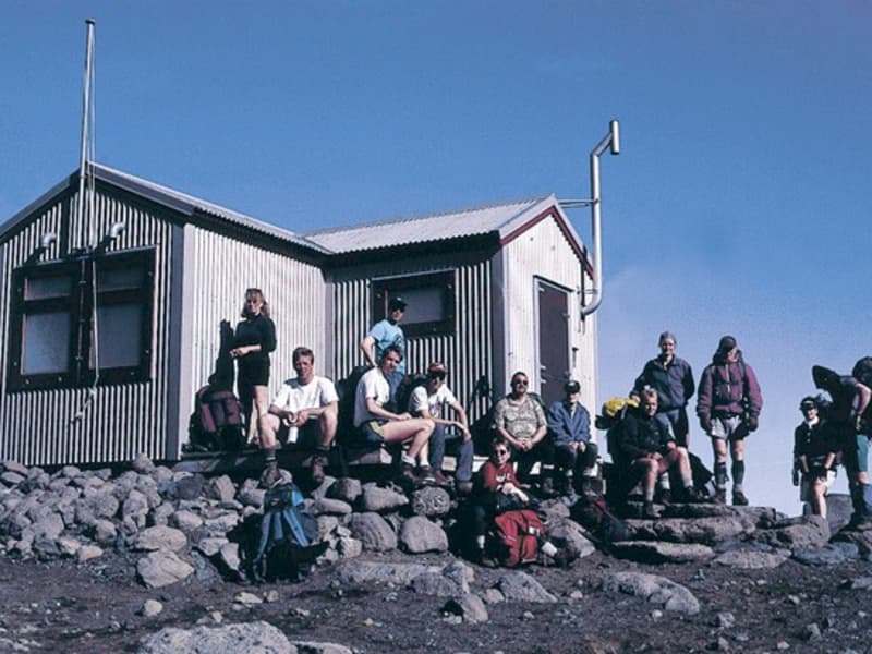
Bræðrafell hut is located SA from the Bræðrafell mountain, just S of the Kollóttadyngja lava shield. The hut was built in 1976-77. The hut sleeps 16 and has a coal-operated stove for cooking and for the heating of the hut. Drinking water is collected from the roof into reservoirs on the sidewalls of the hut. The hut remains open all year round. There is a walking route from the Herðubreið mountain W to the hut, approx. 9-10 km, marked by yellow sticks.
The marked walking GPS: N65°11,31 W16°32,29Primitive facilities.g route continues S to Dreki hut, E of the Dyngjufjöll massif.
Reservations and enquiries: Club office of FFA: e-mail: ffa@ffa.is or phone number: +354 462 2720.See website: https://www.ffa.is/en/huts/huts
View
Botni - Ferðafél. Akureyrar/ITA
Botni hut is located approx. 650 m SSE from the uppermost origin of Suðurá river, near the NW edge of Ódáðahraun lava field. The hut was built in 1996 and sleeps 16. The hut has a kerosene-operated stove for heating and gas cooker for cooking. Drinking water can be obtained from wells some 200 m S of the hut or from the uppermost tributaries of Suðurá river. The hut remains open all year round. There is a walking route from Dyngjufell hut to Botni (20-22 km) and from Botni to Svartákot farm (15-16 km).
GPS: N65°16,18 W17°04,10Primitive facilities.
Reservations and enquiries: Club office of FFA: e-mail: ffa@ffa.is or phone number: +354 462 2720.See website: https://www.ffa.is/en/huts/huts
View
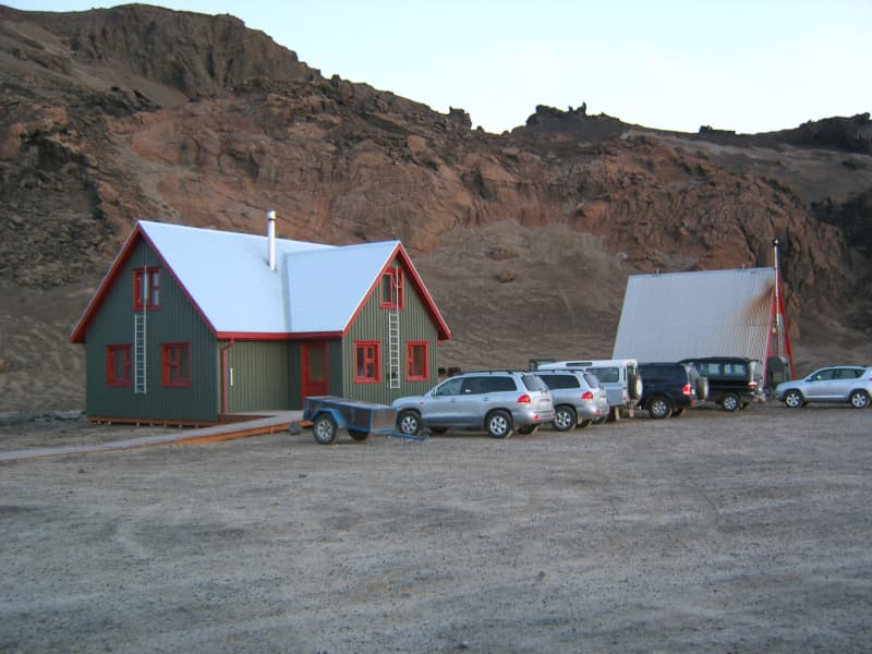
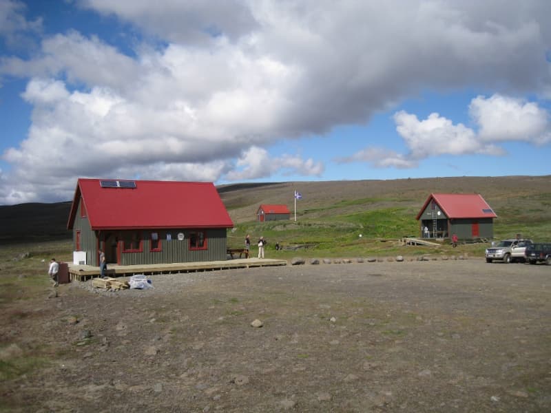
Dreki - Ferðafél. Akureyrar/ITA
Dreki hut is located at the mouth of the Drekagil gorge, just under the E side of the Dyngjufjöll massif. The hut can be reached by mountain road F88 from the ring road east of lakeMyvatnor by mountain road F910. There are two residential huts on the site which sleep a total of 55. The huts have kerosene-operated stoves for the heating of the huts and gas for cooking. There is a sanitary house with WC and shower facilities by the hut, open during the summer months while the hut wardens are in the area. There is a camping site by the hut. The huts are open from approx. 20 June 5 Sept. There is a marked walking trail from the hut W across Dyngjufjöll massif into the Askja caldera and also N to Bræðrafell hut. The Drekagil area is an ideal base for those who wish to explore the Askja caldera (9 km by car).
GPS: N65°02,52 W16°35,72East of Dyngjufjöll mountains. Water, wc.
Reservations and enquiries: Club office of FFA: e-mail: ffa@ffa.is or phone number: +354 462 2720.See website: https://www.ffa.is/en/huts/huts
View
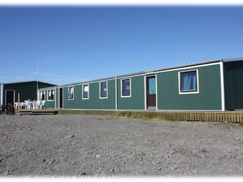
Áfangi
At Afangi there is hostel style accommodation for up to 32 people in 8 rooms, each accommodating 4 people. Its possibility to get made-up bed with linen.
We have fully equipped self-catering kitchen facilities and a dining area for the use of overnight quests and groups. In our café you can buy hot meals (please order in advance),breakfast, lunsh, coffe, waffles, cakes, soups and bread. From our shop we can also packed lunches. Cold soft drinks and sweets. Cold icelandic beer.
Áfangi has a hot jacuzzi and shower - the ideal way to relax after a long day´s journey!!
GPS: N65°08,701 W19°44,148 Stable.
View
Dyngjufell - Ferðafél. Akureyrar/ITA
Dyngjufell hut is located in Dyngjufjalladalur valley, NW of the Dyngjufjöll massif. The hut was built in 1993 and sleeps 16. The hut has a kerosene-operated stove for the heating of the hut and gas cooker for cooking. Drinking water can often be obtained from a small stream which flows N through the valley. The hut remains open all year round. There is a walking route from Dreki hut across the Askja caldera and Dyngjufjöll massif to Dyngjufell hut and from there N to the Botni hut by Suðurárbotnar wells.
GPS: N65°07,48 W16°55,28Primitive facilities.
Reservations and enquiries: Club office of FFA: e-mail: ffa@ffa.is or phone number: +354 462 2720.See website: https://www.ffa.is/en/huts/huts
View
Other (17)
| Baugasel - Ferðafélagið Hörgur/ITA | Baugasel | 604 Akureyri | 899-0205 |
| Tungnahryggsskáli - Mountain Hut | Brimnes | 620 Dalvík | 896 3775 |
| Mosar-Reykjaheiði Mountain Hut | Brimnes | 620 Dalvík | 896 3775 |
| Þeistareykir Mountain Hut | Þeistareykir | 640 Húsavík | 866-4083 |
| Heilagsdalur - Ferðafélag Húsavíkur | Heilagsdalur | 640 Húsavík | 894-0872 |
| Hof - Ferðafélag Húsavíkur | Hof | 640 Húsavík | 894-0872 |
| Árbúðir | Myrkholti, Bláskógabyggð 801 Selfoss | 699-2004 | |
| Kverkfjöll - The Iceland Glaciological Society | 125 Reykjavík | 820-0893 | |
| Réttartorfa | Réttartorfa | 568-4444 | |
| Þúfnavellir - Ferðafélag Skagfirðinga | 550 Sauðárkrókur | 864-5889 | |
| Trölli - Ferðafélag Skagfirðinga | 550 Sauðárkrókur | 864-5889 | |
| Nýidalur - Iceland Touring Association | Mörkin 6, 108 Reykjavík | 568-2533 | |
| Hildarsel | 550 Sauðárkrókur | 864-5889 | |
| Strangakvísl | Gil, 541 Blönduós | 823-5986 | |
| Skiptabakki - 4x4 Tours | Skiptabakki | 894-6233 | |
| Þjófadalir - Iceland Touring Association | Mörkin 6, 108 Reykjavík | 568-2533 | |
| Ingólfsskáli - Skagafjörður Touring Club | 550 Sauðárkrókur | 864-5889 |