North Iceland's mountains are high, majestic, and diverse, featuring a range of geological formations including tuyas, explosive craters, and ancient rock structures. They offer year-round enjoyment, with activities such as hiking in summer and skiing in winter. These mountains are known for their striking beauty, dramatic landscapes, and historical significance, providing both challenging and accessible trails for outdoor enthusiasts. The region's unique geological history is evident in its varied mountain environments, making it a captivating destination for nature lovers.
Spakonufell
Spákonufell is an impressive and dignified mountain towering above Skagaströnd and is looked upon as a kind of emblem of the village. It is frequented in all seasons by those who want to indulge in a variety of outdoor activities.
In summer, there is a choice of good walking and hiking trails, and many highly valued places of interest. And when winter lays an icy hold on the slopes, the townspeople change over to cross-country skiing – making their way round and, in some cases, up the mountain. Booklets about walks on and around Spákonufell and Spákonufellshöfði have been published in Icelandic, English and German, and these can be obtained in many places within the town itself, as well as in tourist information bureaux all over the north of Iceland. They also contain excellent photographs, detailed maps and other items of interest and information.
View
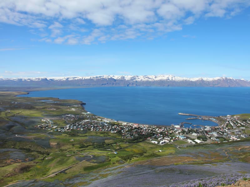
Mt. Húsavíkurfjall
Húsavíkurfjall is a unique landmark located just behind Húsavik. Measuring 417 mt above sea level.Easy hike.
View
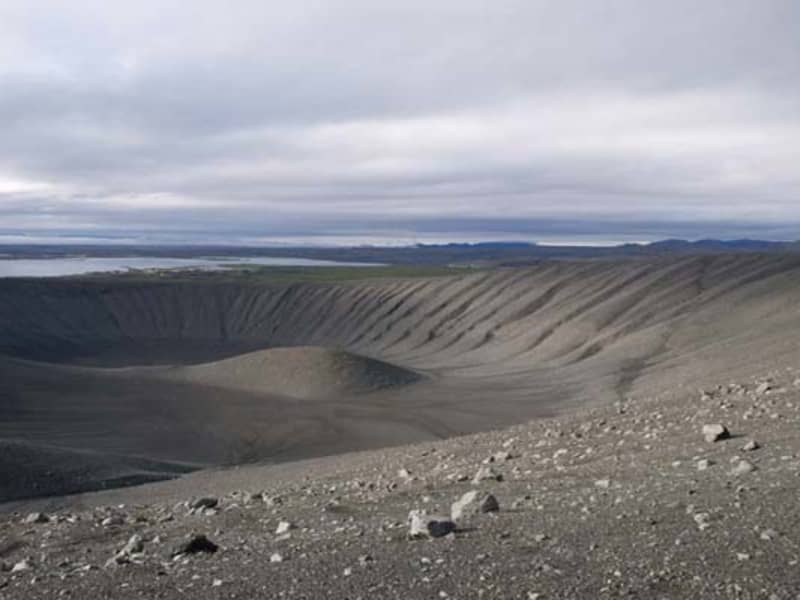
Hverfjall
Hverfjall is a large circular explosion crater in the Mývatn region, approximately 140 metres deep and 1,000 metres in diameter. Formed during a volcanic eruption around 2,800–2,900 years ago, it is one of the largest explosion craters of its kind in the world and a prominent landmark in the surrounding landscape.
A hiking trail leads to the crater rim, where visitors can enjoy panoramic views of Lake Mývatn, the surrounding lava fields and the diverse volcanic features that characterise the area. The crater’s striking symmetry and distinctive shape have made Hverfjall one of the best-known natural landmarks in North Iceland.
View
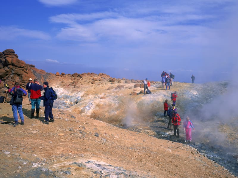
Kverkfjöll
Kverkfjöll is a volcanic mountain range on the northern edge of Vatnajökull glacier and one of the most remote and fascinating destinations in the Icelandic Highlands. Named after the dramatic gorge carved by Kverkjökull glacier, the area is renowned for its striking combination of ice, fire and geothermal activity.
One of Iceland’s most active high-temperature geothermal areas is located in the western part of Kverkfjöll, where steaming vents, hot springs and colourful geothermal formations create an extraordinary landscape. The contrast between the geothermal area and the nearby glacier makes Kverkfjöll one of the country’s most unique natural environments.
The area offers a variety of hiking opportunities, including routes through rugged volcanic terrain and to viewpoints overlooking glaciers and mountain peaks. Access is by mountain roads that are generally open only during the summer months, making a visit to Kverkfjöll a true Highland adventure.
More information about the National Park is at the webpage: www.vatnajokullnationalpark.is
View
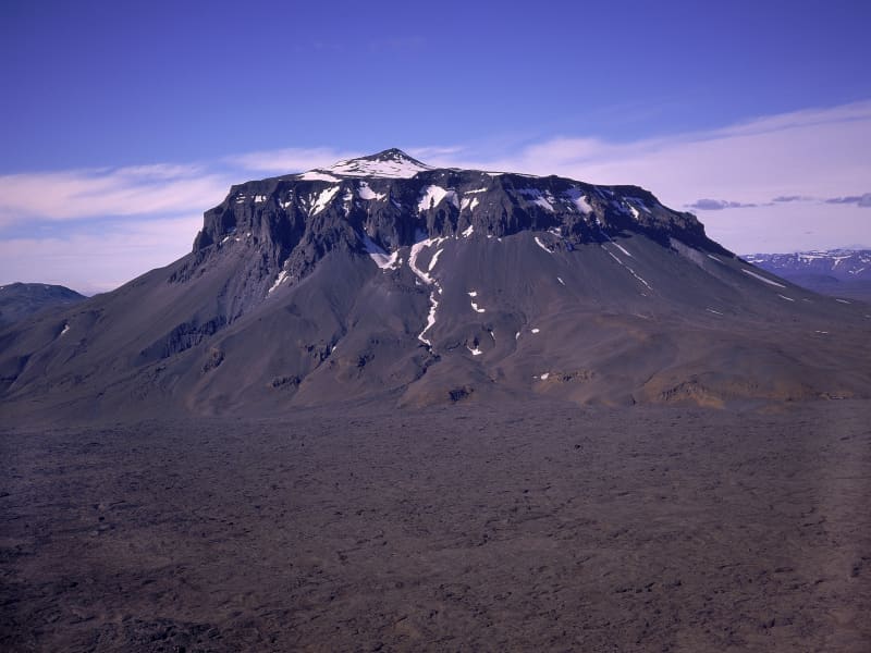
Herðubreið
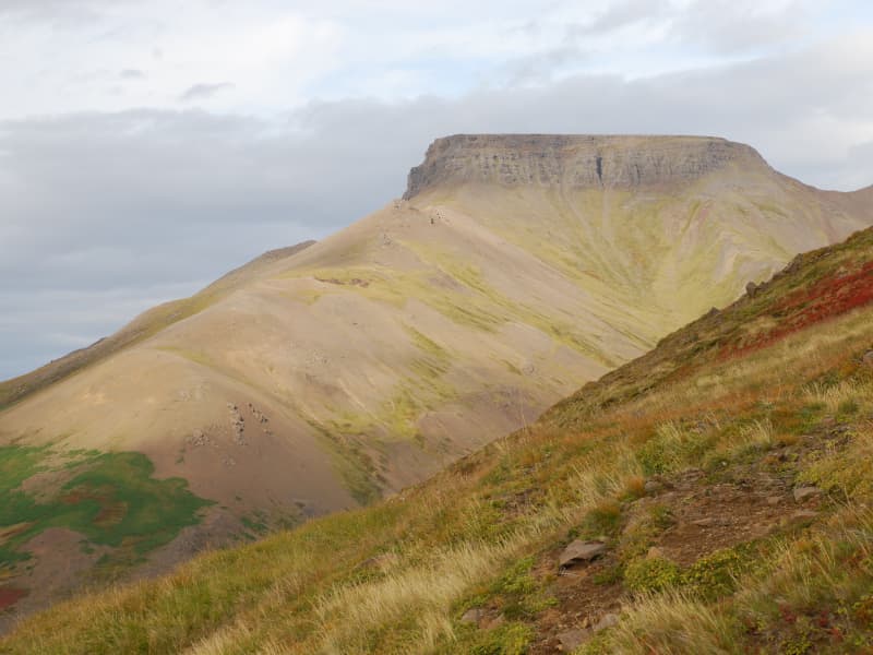
Herðubreið is a striking table mountain rising 1,682 metres above sea level on the Öskjuleið route in the Icelandic Highlands. Often referred to as the “Queen of Icelandic Mountains”, it is widely regarded as one of the country’s most iconic natural landmarks and has been designated Iceland’s national mountain.
Standing prominently above the surrounding lava fields of Ódáðahraun, Herðubreið is renowned for its distinctive shape and commanding presence. Its isolated location and symmetrical form make it a memorable sight for travellers crossing the Highlands.
A hiking trail leads to the summit, but the ascent is steep and challenging due to loose rock and exposed terrain. Those who reach the top are rewarded with far-reaching views across the vast wilderness of the central Highlands.
View
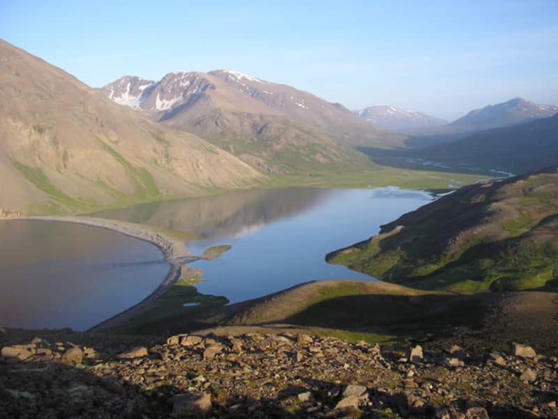
Fjörður
The peninsula between Eyjafjordur and Skjalfandi Bay is a paradise for hikers. Two 4WD tracks lead to the north of the peninsula, one to Hvalvatnsfjordur and the other to Flateyjardalur. No services, but camping allowed in specific areas.
View
Gunnólfsvíkurfjall
Mt. Gunnólfsvíkurfjall in Finnafjörður is the highest mountain in Langanes peninsula, 719 m high and rises from the ocean. On top of the mountain there is a radar station that NATO built in 1987 and today, The Icelandic Coastguard is still operating it. There is allowed to hike up along the road that leads to the top of the mountain and offers a beautiful view.
View