Highland excursions taking you to Herðubreið the “Queen of Mountains”, Kverkfjöll or Hveravellir are extremely popular. Walking in the fresh mountain air or driving along unmade trails in super jeeps and other rough terrain vehicles is an amazing experience. In Arnarvatnsheiði, south of Húnaflói, trout fishing in the wild, lonely nature is a special enjoyment for the keen angler.
Kverkfjöll
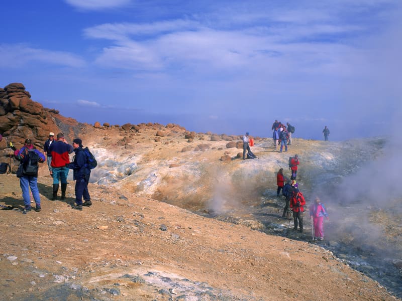
Kverkfjöll is a volcanic mountain range on the northern edge of Vatnajökull glacier and one of the most remote and fascinating destinations in the Icelandic Highlands. Named after the dramatic gorge carved by Kverkjökull glacier, the area is renowned for its striking combination of ice, fire and geothermal activity.
One of Iceland’s most active high-temperature geothermal areas is located in the western part of Kverkfjöll, where steaming vents, hot springs and colourful geothermal formations create an extraordinary landscape. The contrast between the geothermal area and the nearby glacier makes Kverkfjöll one of the country’s most unique natural environments.
The area offers a variety of hiking opportunities, including routes through rugged volcanic terrain and to viewpoints overlooking glaciers and mountain peaks. Access is by mountain roads that are generally open only during the summer months, making a visit to Kverkfjöll a true Highland adventure.
More information about the National Park is at the webpage: www.vatnajokullnationalpark.is
View
Hveravellir
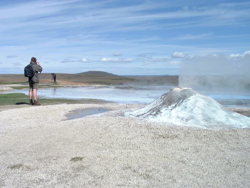
Hveravellir is one of Iceland’s best-known geothermal areas, located on the Kjölur highland route between North and South Iceland. Set amidst the vast wilderness of the central Highlands, the area is known for its steaming fumaroles, colourful hot springs and unique geothermal landscape.
Well-marked walking paths allow visitors to explore the geothermal area and observe the bubbling hot springs and mineral-rich formations up close. One of the highlights of a visit to Hveravellir is the natural hot pool, where travellers can relax and enjoy the surrounding Highland scenery.
Hveravellir is a popular stop along the Kjölur route and offers mountain huts, accommodation and facilities for visitors exploring the Icelandic Highlands.
View
Askja
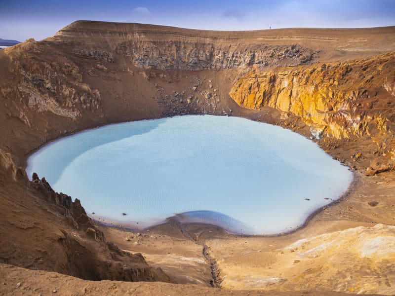
Askja is a 50 km2 caldera in the Dyngjufjoll mountains. The mountains emerged in eruptions under an Ice Age glacier cap. Askja itself was formed, for the most part, at the end of the Ice Age in a major ash eruption which caused the roof of the magma chamber at the heart of the central volcano to subside.
Askja is a part of Vatnajökull National Park.
The caldera contains several volcanoes, including Víti (explosive volcanic crater). Water has accumulated in the crater, its temperature is variable - it is around 30°C on average. Víti is a popular bathing site, but if you intend taking a dip, please be aware that the sloping path is very slippery in wet weather.
The road to Askja goes from road 1 to road 901 and onto mountain road F905. Onward to F910 to Drekagil. On this route there are two fords to cross, usually small. From Drekagil goes mountain road F894 (8 km) to the car park at Vikraborgir.Another option is to go from road 1 to mountain road F88 via Herðubreiðarlindir to Drekagil. On this road ther are fords on the rivers Grafarlandsá and Lindá that need to be crossed. The fords can be difficult or even impassable for small jeeps.
View
Laugafell
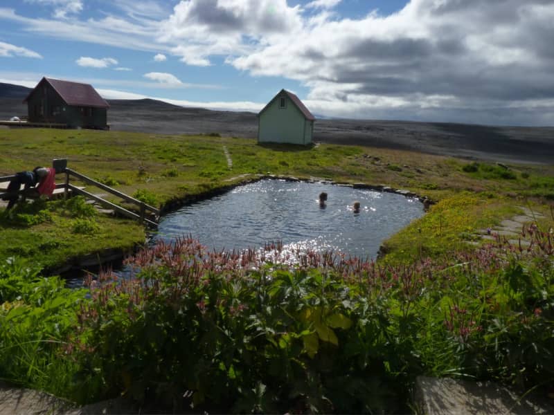
Laugafell is a geothermal oasis in the Icelandic Highlands, located between the glaciers Hofsjökull and Vatnajökull, about 25 kilometres west of the Sprengisandur route. Surrounded by vast wilderness, the area is known for its geothermal hot springs and peaceful Highland setting.
Visitors can enjoy a natural geothermal pool, explore the surrounding landscape and stay in mountain huts that operate during the summer months. The combination of warm geothermal waters and remote Highland scenery makes Laugafell a popular stop for travellers crossing the interior of Iceland.
View
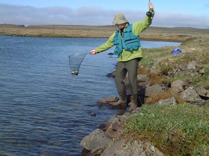
Arnarvatnsheiði
“Eagle Lake moors” is a larg green, lake-studded landscape in the highland, south of Húnaflói. The area extends for 80km or so south to the glaciers of Eiriksjokul and Langjokul. It´s a popular trout fishing venue in a wild, lonely nature. 4WD track.
View
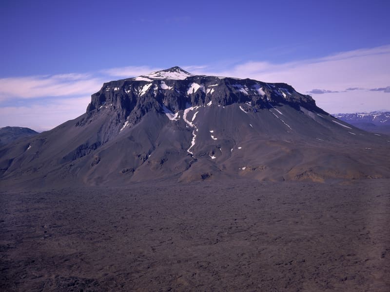
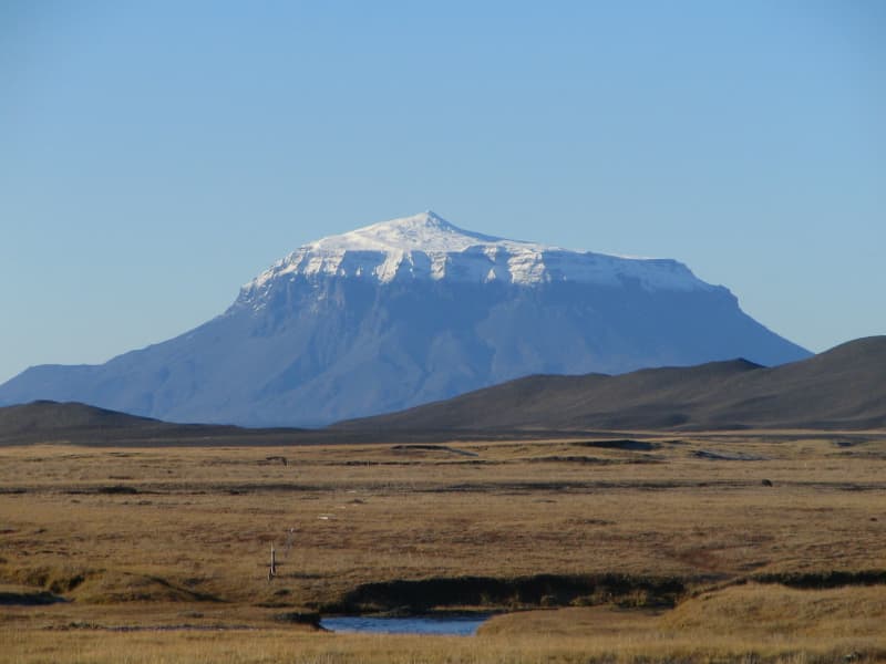
Herðubreið
Herðubreið is a striking table mountain rising 1,682 metres above sea level on the Öskjuleið route in the Icelandic Highlands. Often referred to as the “Queen of Icelandic Mountains”, it is widely regarded as one of the country’s most iconic natural landmarks and has been designated Iceland’s national mountain.
Standing prominently above the surrounding lava fields of Ódáðahraun, Herðubreið is renowned for its distinctive shape and commanding presence. Its isolated location and symmetrical form make it a memorable sight for travellers crossing the Highlands.
A hiking trail leads to the summit, but the ascent is steep and challenging due to loose rock and exposed terrain. Those who reach the top are rewarded with far-reaching views across the vast wilderness of the central Highlands.
View
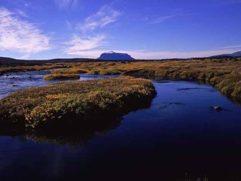
Herðubreiðarlindir
At the foot of Herðubreið are the Herðubreiðarlindir Springs, a spot with magnificent views and diverse natural attributes – which is probably why so many people consider this to be one of the most beautiful places in the country’s wilderness. The road to Herðubreiðarlindir is only passable in summer.
View
Möðrudalur
At an altitude of 469 m, Möðrudalur farm lies higher than any other Icelandic farm. The remarkable, tiny church was built by the farmer himself, Jón Stefánsson, in 1949. The tourist services here operate year-round. Various trails have been marked through the area, which prides itself on wide panoramas and amazing silence. The majestic Mount Herðubreið, looming in the near distance, has long been referred to as the Queen of Icelandic Mountains, but its image was further cultivated in the last century by a self-made painter from Möðrudalur farm, Stefán Jónsson (Stórval).
View
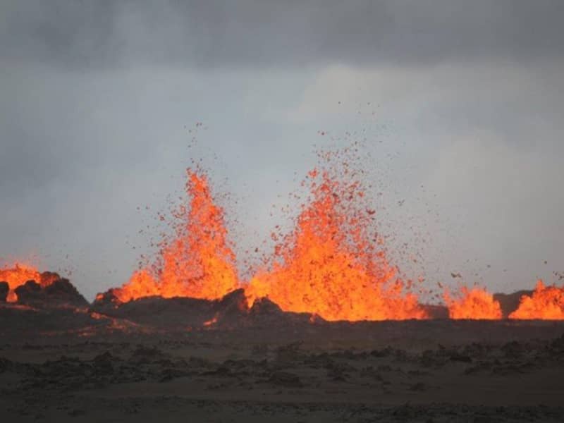
Bárðarbunga
Bárðarbunga, is a stratovolcano located under Vatnajökull, Iceland's most extensive glacier. Rising 2,009 metres above sea level, it is Iceland’s second-highest mountain and a dominant feature of the central Highlands.
The Bárðarbunga volcanic system stretches for approximately 200 kilometres and has played a significant role in shaping Iceland’s landscape through volcanic eruptions and geological activity. Its influence can be seen in the vast lava fields and rugged wilderness that characterise the surrounding Highlands.
Although hidden beneath the ice cap of Vatnajökull, Bárðarbunga remains one of Iceland’s best-known volcanoes and an important reminder of the powerful natural forces that continue to shape the country.
View