North Iceland is an ideal place for all kinds of outdoor activities. Hiking and biking trails, small woodlands, streams and picnic benches, gorges and mountains. There is a lot of variety here and everyone should be able to have a great day in a pleasant environment.
Vaglaskógur Forest
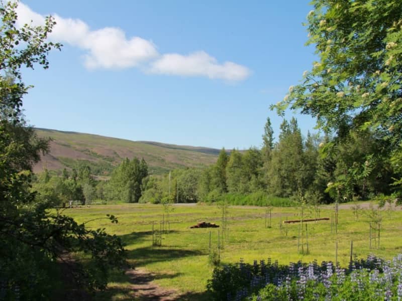
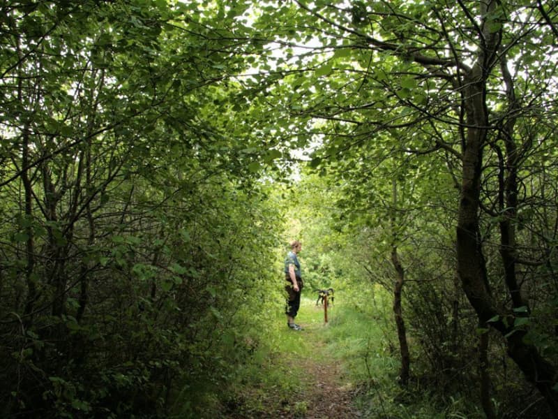
One of the most eye-catching forests in Iceland, situated in Fnjóskadalur Valley short distance to the east from the town of Akureyri. The native Icelandic birch doesn't get much nicer and taller than here. Popular area for recreation with a variety of hiking trails and recreation possibilities. Good camping options.
View
Botnsvatn Lake
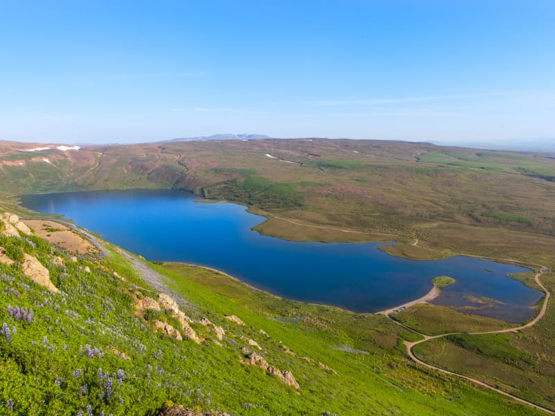
Lake Botnsvatn is a scenic lake located just southeast of Húsavík and is one of the area's most popular outdoor recreation spots. Covering 1.05 km² and situated approximately 130 metres above sea level, the lake is only a short drive from the town centre.
Botnsvatn is the source of the Búðará river, which flows through Húsavík before reaching Skjálfandi Bay. Surrounded by peaceful natural surroundings, the lake is a popular destination for walking, outdoor activities and enjoying the scenery.
A well-known hiking trail circles the lake, covering approximately 5.4 kilometres and offering beautiful views of the surrounding landscape. Visitors can also reach the lake on foot from the town park, Skrúðgarður, by following a marked trail alongside the Búðará river. Along the way, hikers can enjoy views over Húsavík, Skjálfandi Bay and the surrounding countryside.
View
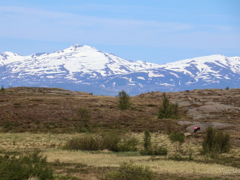
Glerárdalur Valley
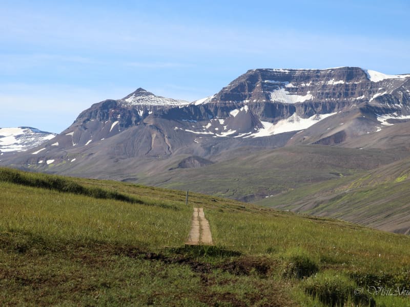
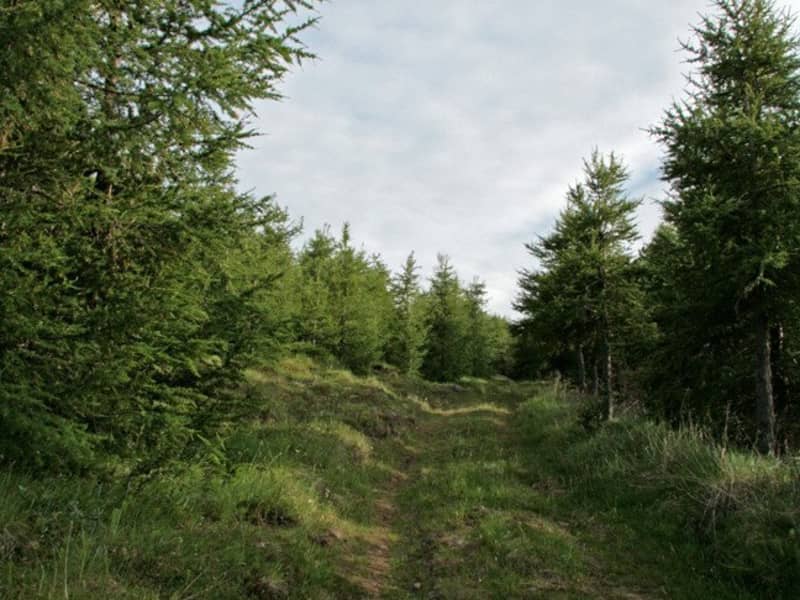
A nice walk leads from the mouth of the valley Glerárdalur to the bottom of it and ends by the mountain cabin named Lambi, some 11 km into the valley.
View
Ásbyrgi Canyon
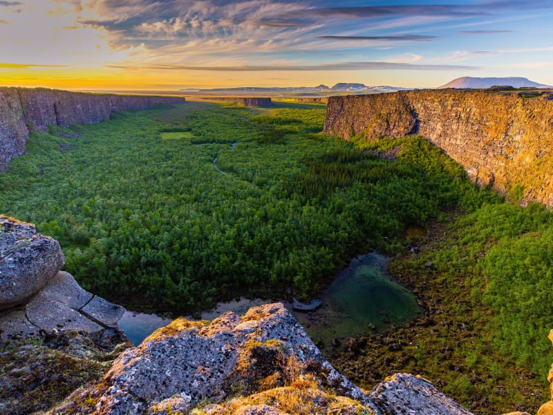
Ásbyrgi is one of Iceland’s most remarkable natural wonders and a highlight of Vatnajökull National Park. The distinctive horseshoe-shaped canyon is surrounded by towering cliffs reaching up to 100 metres in height and filled with lush woodland, creating a peaceful oasis in the heart of North Iceland.
Part of the Jökulsárgljúfur area of the national park, Ásbyrgi is renowned for its unique landscape, rich birdlife and tranquil atmosphere.
According to Icelandic folklore, the canyon was formed by the hoofprint of Sleipnir, Odin’s eight-legged horse, while scientists believe it was shaped by powerful glacial floods thousands of years ago.
A variety of hiking trails lead visitors through the canyon and to viewpoints overlooking the surrounding landscape. The area is well equipped for visitors, with a visitor centre, campsite, shop and one of Iceland’s most scenic golf courses, making it an ideal base for exploring the region.
Ásbyrgi is also one of the key attractions along the Diamond Circle.
View
Akureyri Botanical Garden
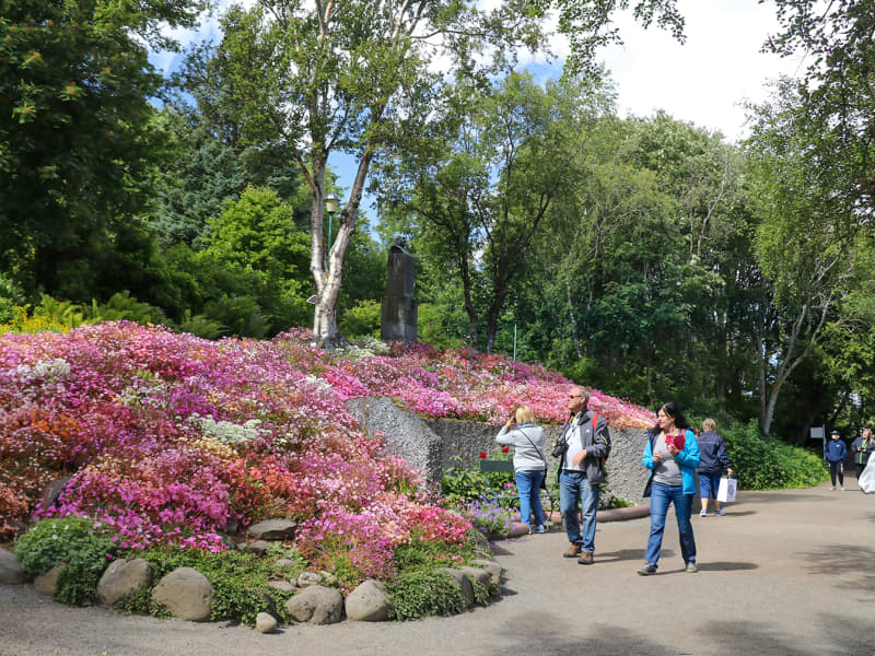
Akureyri Botanical Garden (Lystigarður Akureyrar) is one of the northernmost botanical gardens in the world and a peaceful green oasis in the heart of Akureyri. Established as a public park in 1912, with the botanical garden added in 1957, it has grown into one of the town’s most beloved attractions.
The garden was founded through the initiative of local women, led by Anna Schiöth, whose vision helped create one of Akureyri’s most cherished public spaces. Her daughter-in-law, Margarethe Schiöth, continued the work and played a key role in the development of the garden. A bust of Margarethe stands within the grounds, bearing the inscription: “She made the garden famous.”
Located on the slopes above the town centre, the garden enjoys a favourable microclimate created by Eyjafjörður, allowing an impressive variety of plants to thrive despite its northern location. Alongside Iceland’s native flora, thousands of plant species from around the world can be found throughout the garden, creating a colourful display from spring to autumn.
Visitors can stroll along winding paths, enjoy the diverse plant collections and experience a tranquil setting just a short walk from the centre of Akureyri. The garden also plays an important role in plant conservation, education and international seed exchange.
The Botanical Garden is open daily during the summer season, while the grounds remain accessible year-round for those wishing to enjoy a walk through the park.
View
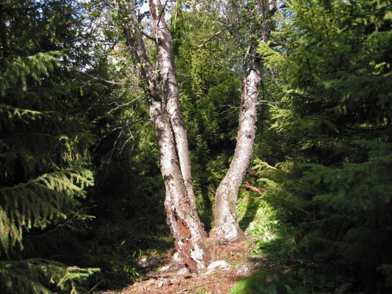
Grund Historical Grove
Historical grove from the year 1900 with many different tree species labeled with taxonomical names and planting year. Seeing and hearing the quaking aspen (Populus tremula) is most certainly worth the visit. The forest is situated 19 km south of Akureyri (road 821).
View
Spákonufellshöfði Headland
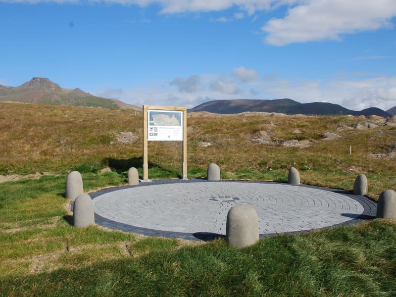
Spákonufellshöfði headland is popular among those interested in walking and other outdoor recreations, and is a short way from the harbour in Skagaströnd.
Marked footpaths have been laid out and signboards erected telling the visitor about the area’s flora and fauna. On a bright, clear summer evening, one can witness the setting of the midnight sun as it dips to touch the horizon in the north. Indeed, the inhabitants of the area make use of the headland all year round and enjoy all that it has to offer.
View
Naustaborgir
Naustaborgir is a scenic outdoor recreation area on the southern edge of Akureyri, connected to the popular Kjarnaskógur woodland. The area is known for its distinctive rock formations, open green spaces, wetlands and diverse birdlife, making it a favourite destination for walking and nature observation.
Several walking trails wind through the area, linking Naustaborgir with both Kjarnaskógur and the nearby golf course. From the highest rock outcrops, visitors can enjoy panoramic views over Akureyri, Eyjafjörður fjord and the surrounding countryside.
The wetlands of Naustaborgir provide an important habitat for birds and plant life. A birdwatching hide overlooking the wetland offers excellent opportunities to observe a variety of species, particularly during the nesting season. Ongoing conservation efforts have focused on restoring the wetland and enhancing biodiversity in the area.
Combining natural beauty, wildlife and easy access from Akureyri, Naustaborgir is an ideal destination for a peaceful walk and a chance to experience nature close to town.
View
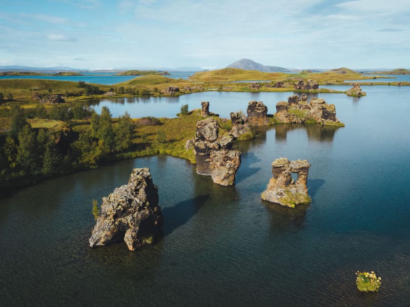
Höfði
Höfði is a rocky promontory which reaches into the waters of Lake Mývatn. The view from here is good, giving a vista of the lake's coves and inlets, besides being an excellent site for bird watching. Kálfastrandarvogur bay laps the shores of Höfði and is famous for its unusual lava formations both off and onshore and these rocky outcrops, named Klasar and Kálfastrandarstrípar, have done much to earn Kálfastrandarvogur and Höfði their reputation for being among the most beautiful areas around Mývatn.
View
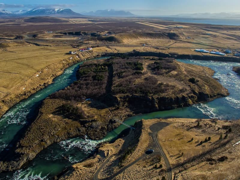
Hrútey
Hrútey Island is the real feather in the cap of Blönduós town, which is almost encircled by the river Blanda. Hrútey is blessed with a wide variety of vegetation and birdlife is abundant, being the habitat of geese and many other species. It is easily accessible and lies just off Highway 1.
There is a good parking area by the river bank and a trusty pedestrian bridge over to the island. Hrútey is an excellent place for outdoor exercise, or just to stop and take a break. There are good footpaths and a clearing with benches and picnic tables.
View
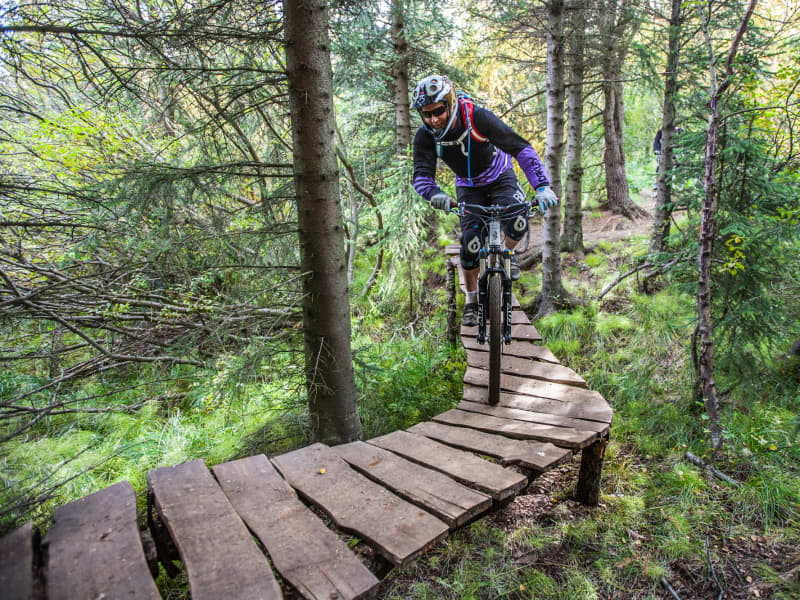
Kjarnaskógur woods
Kjarnaskógur Woods
South of Akureyri is one of the towns most popular outdoor area- the woodland Kjarnaskógur. The recreational area is approx 800hectars with more than 1.5 million trees, of many species planted within thelast 50 years. The area has diverse selection of trees and along the creekBrunná one can find a tree sample track. For bird lovers, the areais rich of birds and by the marshland in the north of the area (by Hundatjörnin Naustaborgir) there is a bird watching shelter. A campsite is nearby,Hamrar, with easy access to the forest.
In the forest you find:
* Three playgrounds * Volleyball courts and outdoor gym* Grill houses and pick-nick areas for both individuals and groups* Aprox. 12 km of gravel-tracks for hiking, running and biking, of which 6 kmare lighted during dark hours. Also plenty of forest tracks and other vastnetwork of back country trails. For more details view the maps further down thepage. * Restrooms and water fountain* 4 carparks* Mountain bike trails are in the woods and are also connected to the mountainbike trails in Mt. Hlíðarfjall - These combined create the longest mountainbike trail in Iceland with a total of 21.6 km.* During winter - the largest organized cross country tracks area (in awoodland area in Iceland) with around 20 km of groomed trails and 6km are lighted. The grooming statues can be viewed here. The colors onthe map indicate the time since they were groomed last (green, orange and pinkare from a couple of hours up to 48 hours, while light blue, dark blue and greyare from 2 days or up to 14 days or more). Areas for sledding are also groomedduring winter, by the statue of the Einar wood-ranger and below the sun-clock.
How to get there:Head south from the town along the road no. 823, pass the airport and turnright by the sign "Kjarnaskogur" and follow the bending road up tothe parking area. Aprox 5 min drive from town center and 30 minutes walk.It is possible to take bus number 1, 2 or 5 from town square,Ráðhústorg, and go out at Kjarnagata/Vallatún, by the golf course. From thereis about two km. walk to Kjarnaskógur area.
Contact info: Skógræktarfélag EyfirðingaSími: (+354) 462 4047Email: ingi@kjarnaskogur.isWebpage: https://www.kjarnaskogur.is/Map of the area: Kjarnaskógur - Easy and shorter walkshttps://www.visitakureyri.is/static/files/2012-VISIT/pdf/kjarnasogur-lettleidir-1-.pdfKjarnaskógur - All tails - overview map https://www.visitakureyri.is/static/files/2012-VISIT/pdf/kort-2018-stora-kortid-a-orva-a2.pdfHamrar - the campingsite and surroundingtrailshttps://www.visitakureyri.is/static/files/2012-VISIT/pdf/kort-2018-hamrar-lett-an-orva.pdfNaustaborgir - Naturereserve area -trails https://www.visitakureyri.is/static/files/2012-VISIT/pdf/kort-2018-naustaborgir-lett-an-orva.pdfGönguskíðabrautir - Crosscountrytrailshttps://www.visitakureyri.is/static/files/2012-VISIT/pdf/gonguskidi.pdf
View
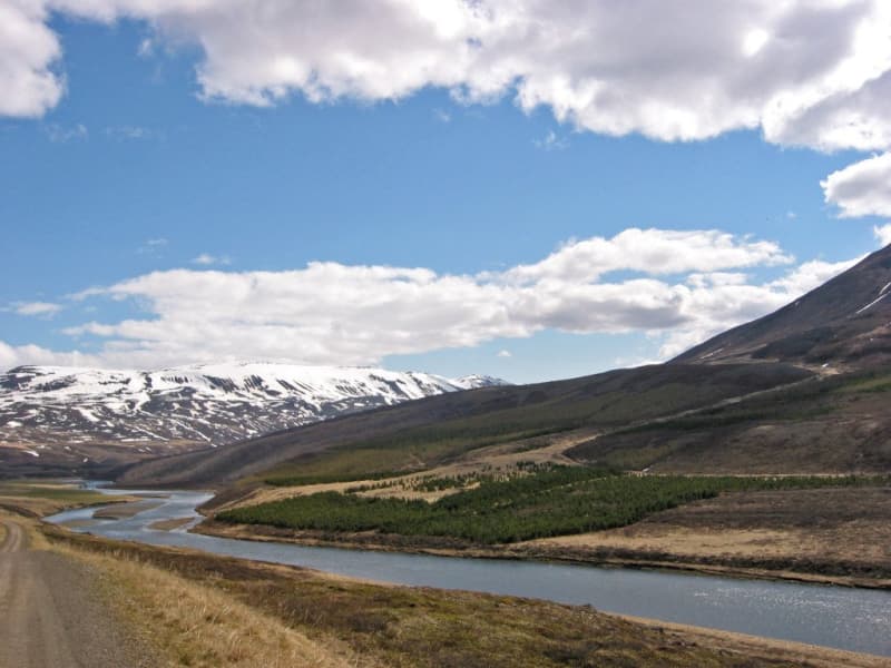
Þórðarstaðir Forest
Native birchwoods in Fnjóskadalur eastward from Akureyri. Along with adjacent forests these are amongst the biggest continuous woodlands in Iceland. Mostly native birchwoods but also stands of Norway spruce, lodgepole pine and Siberian larch.
View
Krossanesborgir
Krossanesborgir is a protected nature reserve just north of Akureyri, offering scenic walking trails, rich birdlife and beautiful views across Eyjafjörður. The area is characterised by rocky outcrops, ponds, wetlands and diverse vegetation, creating a varied landscape that is easily accessible from the town.
Well-maintained paths and birdwatching platforms provide excellent opportunities to explore the reserve and observe its abundant wildlife. Krossanesborgir is particularly popular among birdwatchers during the nesting season, while autumn attracts visitors looking to enjoy the area's colourful vegetation and berry picking opportunities.
The reserve is also of geological interest, with ancient basalt formations shaped by glacial activity thousands of years ago. Combining nature, wildlife and outdoor recreation, Krossanesborgir is a peaceful destination for visitors of all ages.
View
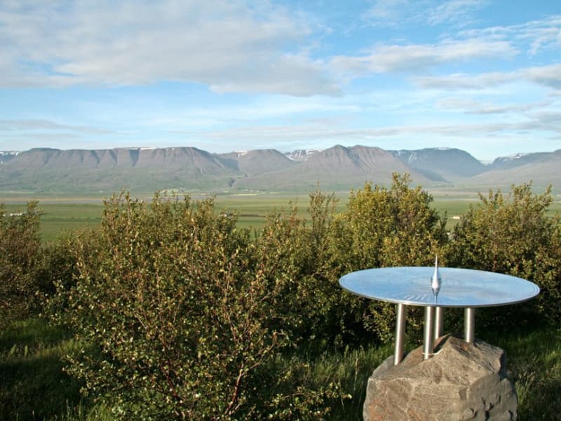
Reykjarhóll Forest
Recreation forest in the outskirts of Varmahlíð Village in Skagafjörður. Ideal for a relaxing stop when traveling Route 1. Walking trails to the top of the hill with a good view over the surrounding landscape. Explore the panoramic disc for the placenames insight.
Nice campsite is adjacent to the forest with good shelter from the winds and fine amenities.
View
Melar & Skuggabjörg Forest
Among the greatest birchwoods in Iceland located in Fnjóskadalur eastward from the town of Akureyri. The Icelandic downy birch doesn't get much taller elsewhere. Some conifer plantations too.
View
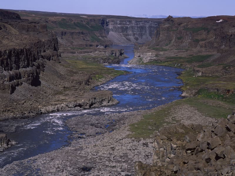
Jökulsárgljúfur Canyon
This dramatic canyon, Jökulsárgljúfur, was formed by the actions of water, fire and ice. Enormous, catastrophic glacial bursts are believed to have carved out the deep ravines and rocky basins, the most famous of which is Ásbyrgi.The Hljóðaklettar outcrops are the cores of ancient volcanoes, revealed when the river swept away all the loose volcanic material.The waterfalls on the River Jökulsá á Fjöllum, Selfoss, Dettifoss, Hafragilsfoss and Réttarfoss are powerful and impressive.The Hólmatungur district is an area of contrasts: crystal clear streams and bubbling brooks cross the land before emptying into the raging, chocolate-coloured torrent. A delicate balance of flora and fauna thrives under the protection of cliffs and scree slopes.
View

Glerá Canyons
Glerárgil has the deepest and most magnificent river gorges in Eyjafjörður but also one of the most vegetated. There are good walking paths along the gorge and there are about 8 bridges over the river, some for mixed traffic such as cars and pedestrians, while others are exclusively for bicycles and walking.
View
Vaglir Forest
Vaglir forest has fine recreation possibilities. Located just 14 km west of Akureyri (by Route 1) and is one of the future recreation forests of the Akureyri area. Mixed forest with a variety of species in a variable landscape. There is a small parking area and slopes that lead the way through the forest.
View
Kristnes Forest
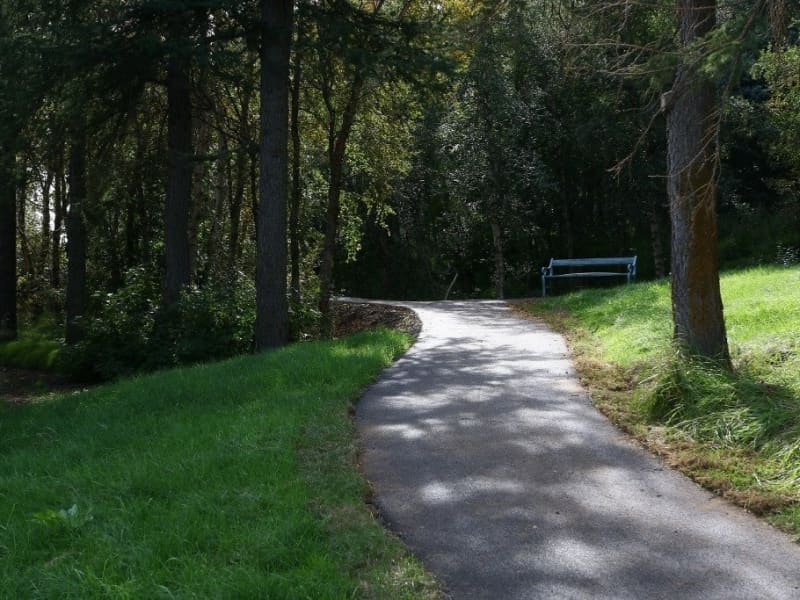
Forest area 10 km south of Akureyri town (road 821). Varied recreation forest effectively used for health and rehabilitation purposes. Originally grown as a recreation area for patients at the tuberculosis sanatorium now housing geriatric and rehabilitation wards. The forest boasts a 300 m long paved path with a beautiful view.
View