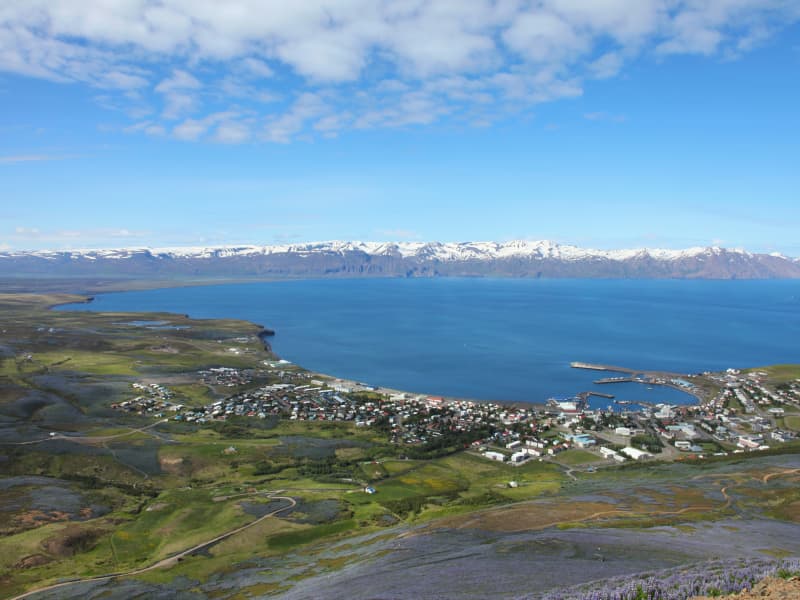
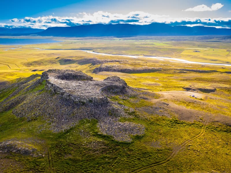
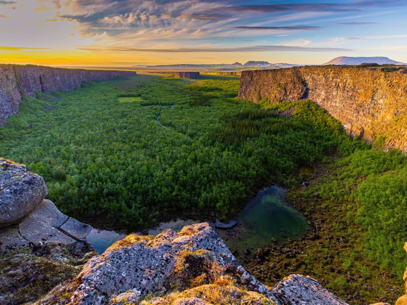
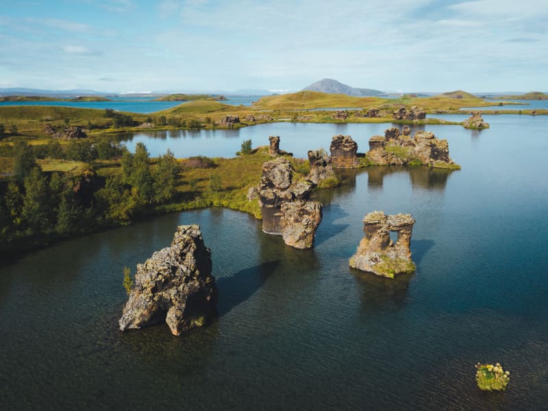
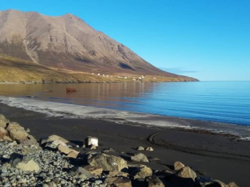
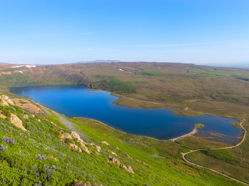
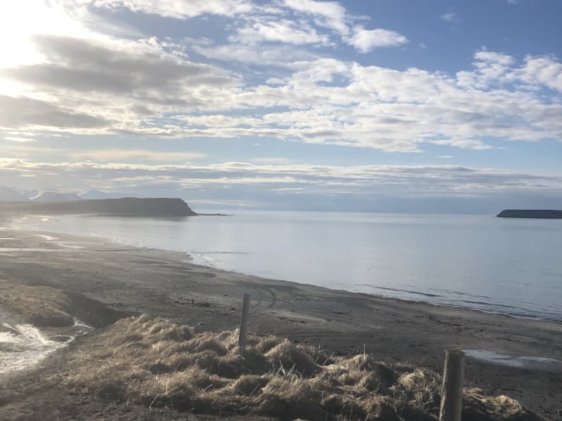
Skip to content

Or try searching by Category and/or Location

Ideas for the Family?

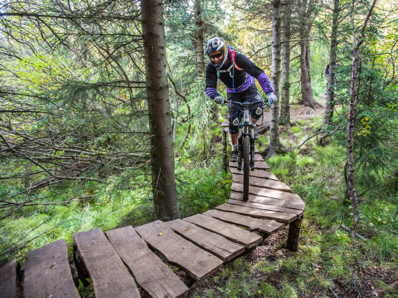
North Iceland is an ideal destination for families, offering a variety of unique natural experiences that cater to children of all ages. The region boasts diverse wildlife and birdwatching opportunities, where kids can learn about different species in their natural habitats.

Geothermal areas feature bubbling mud pools and colorful mineral deposits, providing a fascinating and educational experience. Numerous waterfalls, each with their own impressive views and historical significance, offer both beauty and learning opportunities.

There are also serene hiking trails and tranquil spots perfect for peaceful family outings. The geothermal hot springs in the region allow for a mix of adventure and relaxation, making them perfect for family enjoyment. With its combination of natural beauty, educational opportunities, and accessible outdoor activities, North Iceland ensures a memorable experience for families.

Dalvík Beach
In the harbour of Dalvík, at its southern end, is a little wooden bridge over the rock dam and offers access to a beautiful black sandy beach that invites to take a walk until you reach the delta of the river Svarfaðardalsá. Take a rest in the dunes and observe the rich birdlife.
Ólafsfjörður Beach
Leave the village of Ólafsfjörður on its north end in direction "Kleifar" and you will reach the beautiful black sandy beach with invites to take a stop and walk the beach. Park your car carefully in a designated parking area or in the village and take a walk.
Spákonufellshöfði Headland
Spákonufellshöfði headland is popular among those interested in walking and other outdoor recreations, and is a short way from the harbour in Skagaströnd. Marked footpaths have been laid out and signboards erected telling the visitor about the area’s flora and fauna. On a bright, clear summer evening, one can witness the setting of the midnight sun as it dips to touch the horizon in the north. Indeed, the inhabitants of the area make use of the headland all year round and enjoy all that it has to offer.
Krossanesborgir
Krossanesborgir is a protected nature reserve just north of Akureyri, offering scenic walking trails, rich birdlife and beautiful views across Eyjafjörður. The area is characterised by rocky outcrops, ponds, wetlands and diverse vegetation, creating a varied landscape that is easily accessible from the town. Well-maintained paths and birdwatching platforms provide excellent opportunities to explore the reserve and observe its abundant wildlife. Krossanesborgir is particularly popular among birdwatchers during the nesting season, while autumn attracts visitors looking to enjoy the area's colourful vegetation and berry picking opportunities. The reserve is also of geological interest, with ancient basalt formations shaped by glacial activity thousands of years ago. Combining nature, wildlife and outdoor recreation, Krossanesborgir is a peaceful destination for visitors of all ages. 
Hverfjall
Hverfjall is a large circular explosion crater in the Mývatn region, approximately 140 metres deep and 1,000 metres in diameter. Formed during a volcanic eruption around 2,800–2,900 years ago, it is one of the largest explosion craters of its kind in the world and a prominent landmark in the surrounding landscape. A hiking trail leads to the crater rim, where visitors can enjoy panoramic views of Lake Mývatn, the surrounding lava fields and the diverse volcanic features that characterise the area. The crater’s striking symmetry and distinctive shape have made Hverfjall one of the best-known natural landmarks in North Iceland. 
Höfðagerðissandur Beach
Nice beach close to the town Húsavík. 
Flatey Island
Flatey is a peaceful island off the coast of Skjálfandi Bay, offering visitors a unique glimpse into Iceland’s past. With its colourful historic houses, quiet walking paths and rich birdlife, the island provides a tranquil escape from modern life and a chance to experience a slower pace of living. Although no one has lived permanently on Flatey since the late 1960s, many of the original houses have been carefully maintained by descendants of former residents and continue to be used during the summer months. The island’s church, lighthouse, old schoolhouse and harbour serve as reminders of a once-thriving fishing community. Flatey is also renowned for its abundant birdlife. More than 30 bird species can be observed on the island during summer, including puffins, Arctic terns and eider ducks. The combination of wildlife, history and peaceful surroundings makes Flatey a memorable destination for visitors exploring North Iceland. 
Skúlahóll
Skúlahóll is one of the hills in of the cluster Vatnsdalshólar in Vatnsdalur Valley. From the hill is a beautiful view over the lake Flodid, which was formed in a landslide from the mountain across the valley in 1720. 
Naustaborgir
Naustaborgir is a scenic outdoor recreation area on the southern edge of Akureyri, connected to the popular Kjarnaskógur woodland. The area is known for its distinctive rock formations, open green spaces, wetlands and diverse birdlife, making it a favourite destination for walking and nature observation. Several walking trails wind through the area, linking Naustaborgir with both Kjarnaskógur and the nearby golf course. From the highest rock outcrops, visitors can enjoy panoramic views over Akureyri, Eyjafjörður fjord and the surrounding countryside. The wetlands of Naustaborgir provide an important habitat for birds and plant life. A birdwatching hide overlooking the wetland offers excellent opportunities to observe a variety of species, particularly during the nesting season. Ongoing conservation efforts have focused on restoring the wetland and enhancing biodiversity in the area. Combining natural beauty, wildlife and easy access from Akureyri, Naustaborgir is an ideal destination for a peaceful walk and a chance to experience nature close to town. 
Borgarsandur Beach
East of the town Sauðarkrókur lays the beautiful black sand beach with dunes and marram grass. It is easy to park the car at the west end of the beach and take a walk to enjoy the view over Skagafjörður. 
Fjallahöfn Beach
The road No.85 leaves the steep cliffs on the east side of Tjörnes peninsula and reaches the flat area of Öxnafjörður. A small parking option left of the road offers the best opportunities to walk to the black sandy beach and enjoy great views along the endless beaches of Öxnafjörður. Please don´t try to access the beach by car! 
Akureyri Botanical Garden
Akureyri Botanical Garden (Lystigarður Akureyrar) is one of the northernmost botanical gardens in the world and a peaceful green oasis in the heart of Akureyri. Established as a public park in 1912, with the botanical garden added in 1957, it has grown into one of the town’s most beloved attractions. The garden was founded through the initiative of local women, led by Anna Schiöth, whose vision helped create one of Akureyri’s most cherished public spaces. Her daughter-in-law, Margarethe Schiöth, continued the work and played a key role in the development of the garden. A bust of Margarethe stands within the grounds, bearing the inscription: “She made the garden famous.” Located on the slopes above the town centre, the garden enjoys a favourable microclimate created by Eyjafjörður, allowing an impressive variety of plants to thrive despite its northern location. Alongside Iceland’s native flora, thousands of plant species from around the world can be found throughout the garden, creating a colourful display from spring to autumn. Visitors can stroll along winding paths, enjoy the diverse plant collections and experience a tranquil setting just a short walk from the centre of Akureyri. The garden also plays an important role in plant conservation, education and international seed exchange. The Botanical Garden is open daily during the summer season, while the grounds remain accessible year-round for those wishing to enjoy a walk through the park. 
Seals
Sellátur is the Icelandic name given to an area by the sea which is the breeding ground for seals and these are to be found wherever seal colonies have settled. The breeding grounds are usually close to the tidemark and seals can be seen lying on the beach or splashing around in the sea at high tide. In each colony there can be as few as one or two animals or as many as several hundreds. Vatnsnes is the best place in the north to study these creatures.
Þrístapar
Thristapar and the last execution in Iceland 1830 Practically on the Ring Road in the northwestern region of Iceland is an interesting place called Þrístapar or Triple Hillocks. Although this part of the area is well known for its cone-like hillocks called Vatnsdalshólar (Water-valley-hillocks), most of the small hillocks are on the south side of the road. Hundreds (or some say thousands) of them are in a cluster called Vatnsdalshólar scattered over a five-square-kilometer area. Þrístapar, on the other hand, which consists of three adjoining small hillocks, is on the north side of the road. Around them are only two or three other smaller ones. On a cold day at the beginning of January in 1830, a double beheading took place at Þrístapar, when Agnes Magnúsdóttir and Friðrik Sigurðsson were executed. They had been sentenced to death for murdering Natan Ketilsson and Pétur Jónsson at the farm Illugastaðir, located on the west side of the Vatnsnes Peninsula. The slaying took place two years before in March 1828 and was quite brutal as both men were knocked through the skull with a hammer, stabbed multiple times, and burned when the farm was put to flames after the atrocity. As the district commissioner at the time of execution was of the opinion that vandalism was far too frequent in his jurisdiction, he decided to make the execution an example and a warning. After the beheading, the two heads were put on a stick-on top of Þrístapar for display, and the corpse buried in the field nearby. This was the last execution in Iceland.An audio guide is available in English. Listen to it here: https://thristapar.newreality.is/ Will the pauper and abundant child Agnes become a historical celebrity? Agnes Magnúsdóttir was, without doubt, a witty and intelligent woman but from the time she was born, underprivileged and poor. She was left at a farm and abundant by her mother at an early age and became a pauper living at the mercy of others. In her time she was hardly noticeable but had the drive and intelligence to crave for something more, to move up the social ladder. Ironically she is becoming one of the best-known persons from these parts of Iceland and might be on her way to gain international fame. Her story has received more attention after Hannah Kent published her debut historical novel Burial Rites in 2013 about Agnes and the event leading to her execution.  You can listen to a story from this event at the Arctic Coast Way site: https://www.arcticcoastway.is/en/stories/vatnsnes-1 
Ánastaðastapi Rock Formation
Ánastaðastapi is a striking sea stack on the eastern side of the Vatnsnes Peninsula in Northwest Iceland, located near the farm Ánastaðir along Road 711. Shaped by centuries of wind and wave erosion, the narrow rock formation rises dramatically from the shoreline and is one of the lesser-known natural gems of the region. A short walk from the parking area leads visitors down to the coast, where the sea stack and surrounding shoreline can be explored. The area offers beautiful coastal scenery, fresh sea air and opportunities to spot seals resting along the shore. Ánastaðastapi is also connected to a remarkable chapter in local history. In the spring of 1882, dozens of whales became stranded near Hvalshöfði, a small bay close to the sea stack. The event provided an important source of food for local communities during a difficult period, and people travelled from across the region to make use of the unexpected bounty. For those wishing to explore further, a coastal walking route follows the shoreline south towards Grímsá, passing sea stacks, rocky beaches and open views across Húnaflói. Please note that access to the area may be restricted until July due to the lambing season. 
Gasir - Medival Trading place
Gásir is a unique place. In no other place in Iceland is it possible to find so many remainings from a trading post from the Middle Ages. Gásir was the main trading post in northern Iceland during the Middle Ages, and the place is mentioned many times in Old Icelandic Sagas from the 13th and 14th centuries. Archaeological digging in the area during the last six years has shown that it was a trading post up to the 16th century, possibly until trading started in Akureyri.
Arctic Henge
Located in Raufarhöfn, one of Iceland’s northernmost villages, the Arctic Henge (Heimskautsgerðið) is a unique monument inspired by Norse mythology, astronomy and the dramatic light of the Arctic. Often compared to Stonehenge, the structure is designed to interact with the sun, casting light and shadows through its aligned gateways throughout the year. The idea for the Arctic Henge was developed by local visionary Erlingur Thoroddsen and later designed by artist Haukur Halldórsson. Inspired by the dwarf names found in the Eddic poem Völuspá, the monument combines ancient mythology with modern artistic interpretation, creating a symbolic calendar connected to the seasons and the passage of time. Perched on a hill overlooking Raufarhöfn, the Arctic Henge offers expansive views of the surrounding landscape and the Arctic Ocean. Its geometry, gateways and stone structures create ever-changing patterns of light, particularly during the midnight sun and the long twilight hours of the north. As construction continues, the Arctic Henge remains one of Iceland’s most intriguing and distinctive cultural landmarks.  For more information about the Arctic Henge and the vision behind this unique monument, visit arctichenge.com .  Getting There The Arctic Henge is located on a hill overlooking the village of Raufarhöfn in Northeast Iceland. The site is easily accessible by road and is approximately 130 km from Húsavík Once in Raufarhöfn, the monument is clearly visible above the village. Visitors can either drive up to the site or enjoy a short walk to the monument while taking in the surrounding views. 
Botnsvatn Lake
Lake Botnsvatn is a scenic lake located just southeast of Húsavík and is one of the area's most popular outdoor recreation spots. Covering 1.05 km² and situated approximately 130 metres above sea level, the lake is only a short drive from the town centre. Botnsvatn is the source of the Búðará river, which flows through Húsavík before reaching Skjálfandi Bay. Surrounded by peaceful natural surroundings, the lake is a popular destination for walking, outdoor activities and enjoying the scenery. A well-known hiking trail circles the lake, covering approximately 5.4 kilometres and offering beautiful views of the surrounding landscape. Visitors can also reach the lake on foot from the town park, Skrúðgarður, by following a marked trail alongside the Búðará river. Along the way, hikers can enjoy views over Húsavík, Skjálfandi Bay and the surrounding countryside. 
Höfði
Höfði is a rocky promontory which reaches into the waters of Lake Mývatn. The view from here is good, giving a vista of the lake's coves and inlets, besides being an excellent site for bird watching. Kálfastrandarvogur bay laps the shores of Höfði and is famous for its unusual lava formations both off and onshore and these rocky outcrops, named Klasar and Kálfastrandarstrípar, have done much to earn Kálfastrandarvogur and Höfði their reputation for being among the most beautiful areas around Mývatn.
Borgarvirki
Borgarvirki is a 10-15 metre high ridge of columnar rock. This phenomenon is a volcanic plug, and there is speculation as to whether it was, in ancient times, a district fortress and even, perhaps, a battleground.From Borgarvirki there is a wide panoramic view over a large part of the region and a viewfinder is in place to help locate some of the important landmarks.This is truly a unique natural phenomenon, but one which has also seen some improvements by the hand of man in bygone days.
Kjarnaskógur woods
 Kjarnaskógur Woods  South of Akureyri is one of the towns most popular outdoor area- the woodland Kjarnaskógur. The recreational area is approx 800hectars with more than 1.5 million trees, of many species planted within thelast 50 years. The area has diverse selection of trees and along the creekBrunná one can find a tree sample track. For bird lovers, the areais rich of birds and by the marshland in the north of the area (by Hundatjörnin Naustaborgir) there is a bird watching shelter. A campsite is nearby,Hamrar, with easy access to the forest.   In the forest you find:  * Three playgrounds * Volleyball courts and outdoor gym* Grill houses and pick-nick areas for both individuals and groups* Aprox. 12 km of gravel-tracks for hiking, running and biking, of which 6 kmare lighted during dark hours. Also plenty of forest tracks and other vastnetwork of back country trails. For more details view the maps further down thepage. * Restrooms and water fountain* 4 carparks* Mountain bike trails are in the woods and are also connected to the mountainbike trails in Mt. Hlíðarfjall - These combined create the longest mountainbike trail in Iceland with a total of 21.6 km.* During winter - the largest organized cross country tracks area (in awoodland area in Iceland) with around 20 km of groomed trails and 6km are lighted. The grooming statues can be viewed here. The colors onthe map indicate the time since they were groomed last (green, orange and pinkare from a couple of hours up to 48 hours, while light blue, dark blue and greyare from 2 days or up to 14 days or more). Areas for sledding are also groomedduring winter, by the statue of the Einar wood-ranger and below the sun-clock.  How to get there:Head south from the town along the road no. 823, pass the airport and turnright by the sign "Kjarnaskogur" and follow the bending road up tothe parking area. Aprox 5 min drive from town center and 30 minutes walk.It is possible to take bus number 1, 2 or 5 from town square,Ráðhústorg, and go out at Kjarnagata/Vallatún, by the golf course. From thereis about two km. walk to Kjarnaskógur area.   Contact info: Skógræktarfélag EyfirðingaSími: (+354) 462 4047Email: ingi@kjarnaskogur.isWebpage: https://www.kjarnaskogur.is/Map of the area: Kjarnaskógur - Easy and shorter walkshttps://www.visitakureyri.is/static/files/2012-VISIT/pdf/kjarnasogur-lettleidir-1-.pdfKjarnaskógur - All tails - overview map https://www.visitakureyri.is/static/files/2012-VISIT/pdf/kort-2018-stora-kortid-a-orva-a2.pdfHamrar - the campingsite and surroundingtrailshttps://www.visitakureyri.is/static/files/2012-VISIT/pdf/kort-2018-hamrar-lett-an-orva.pdfNaustaborgir - Naturereserve area -trails https://www.visitakureyri.is/static/files/2012-VISIT/pdf/kort-2018-naustaborgir-lett-an-orva.pdfGönguskíðabrautir - Crosscountrytrailshttps://www.visitakureyri.is/static/files/2012-VISIT/pdf/gonguskidi.pdf 
Dimmuborgir
Dimmuborgir, often referred to as the “Dark Castles” or “Dark Cities”, is one of the most distinctive lava formations in Iceland. Located in the Mývatn region, the area is characterised by dramatic lava pillars, caves, arches and unusual rock formations created by a volcanic eruption thousands of years ago. A network of walking trails winds through this fascinating landscape, where visitors can explore natural lava structures of all shapes and sizes. Among the best-known formations is Kirkjan (“The Church”), a striking lava cave named for its high arching ceiling and cathedral-like appearance. Dimmuborgir has long been associated with Icelandic folklore and is said to be the home of the Icelandic Yule Lads.  The area can be explored year-round, with each season offering a different perspective on its remarkable lava formations and unique landscape. 
Hvítserkur
Hvítserkur is a striking 15-metre-high sea stack rising from the sea just off the eastern shore of the Vatnsnes Peninsula. Shaped by centuries of wave erosion, the basalt formation resembles a giant creature drinking from the ocean and is one of North Iceland’s most iconic natural landmarks. According to local folklore, Hvítserkur is a petrified troll from the Strandir region who set out to destroy the church bells at Þingeyrarkirkja. Unable to reach his destination before sunrise, he was turned to stone by the first rays of the morning sun. The area is renowned for its rich wildlife, with excellent opportunities to spot seals along the shoreline and seabirds nesting on and around the rock during summer.  Visitors can also walk down to the beach for a closer view of the sea stack and the surrounding coastline. 
Lambanes Beach
The gravel road 869 discovers the peninsula Langanes. A beautiful beach near the farm sign to Ýtra-Lón Guesthouse is one of the rare sandy beaches which are not black in Iceland. A small birding house gives opportunities to observe the rich birdlife. But don´t miss to walk this beautiful beach! Lambanes beach is a summer destination. 
Ásbyrgi Canyon
Ásbyrgi is one of Iceland’s most remarkable natural wonders and a highlight of Vatnajökull National Park. The distinctive horseshoe-shaped canyon is surrounded by towering cliffs reaching up to 100 metres in height and filled with lush woodland, creating a peaceful oasis in the heart of North Iceland. Part of the Jökulsárgljúfur area of the national park, Ásbyrgi is renowned for its unique landscape, rich birdlife and tranquil atmosphere.  According to Icelandic folklore, the canyon was formed by the hoofprint of Sleipnir, Odin’s eight-legged horse, while scientists believe it was shaped by powerful glacial floods thousands of years ago. A variety of hiking trails lead visitors through the canyon and to viewpoints overlooking the surrounding landscape. The area is well equipped for visitors, with a visitor centre, campsite, shop and one of Iceland’s most scenic golf courses, making it an ideal base for exploring the region.  Ásbyrgi is also one of the key attractions along the Diamond Circle.
Mt. Húsavíkurfjall
Húsavíkurfjall is a unique landmark located just behind Húsavik. Measuring 417 mt above sea level.Easy hike. 
Bjarg í Miðfirði
Bjarg in Midfjordur, is the farm that belonged to Asdis, the mother of outlaw Grettir Asmundarson - Grettir the Strong, of Grettis Saga fame. Beneath a rock in the hayfield, Asdis buried Gretti´s head, which was presented to her by his killer. There´s now a monument in her honour on site.