
Drive the Arctic Coast Way: A North Iceland Road Trip Itinerary

Exploring the Arctic Coast Way
The Arctic Coast Way is not about rushing from one end to the other. The route connects 21 towns and fishing villages, with plenty of opportunities to meet local people, explore the region’s coastal culture and take spontaneous detours along the way. Parts of the route are gravel, and conditions can vary between seasons, so allow plenty of time, check the roads before setting out and treat the itinerary below as a flexible starting point for your journey.
Day 1: Hvammstangi to Vatnsnes Peninsula
Kick off your journey in Hvammstangi, a tranquil harbor town where seals are known to bask along the shoreline, before setting out on a loop around the rugged Vatnsnes Peninsula.
A few highlights along the route include:
- Hvítserkur – a 15-metre basalt sea stack said to resemble a rhino or dinosaur drinking from the sea.
- Borgarvirki – a volcanic plug shaped like a natural fortress, with panoramic views over the surrounding landscape.
- Þrístapar– the historic site of Iceland’s last execution in 1830.
End the day in Blönduós, a small town beside the glacial river Blanda. Walk along the river or cross the footbridge to Hrútey island, where short trails lead through an area rich in birdlife. Take some time to explore the town’s museums and local culture, enjoy a meal or relax in the swimming pool before settling in for the night.
Winter note: Roads around the Vatnsnes Peninsula are not always suitable for winter travel. Check road and weather conditions before setting out and stay on Route 1 if conditions are poor.
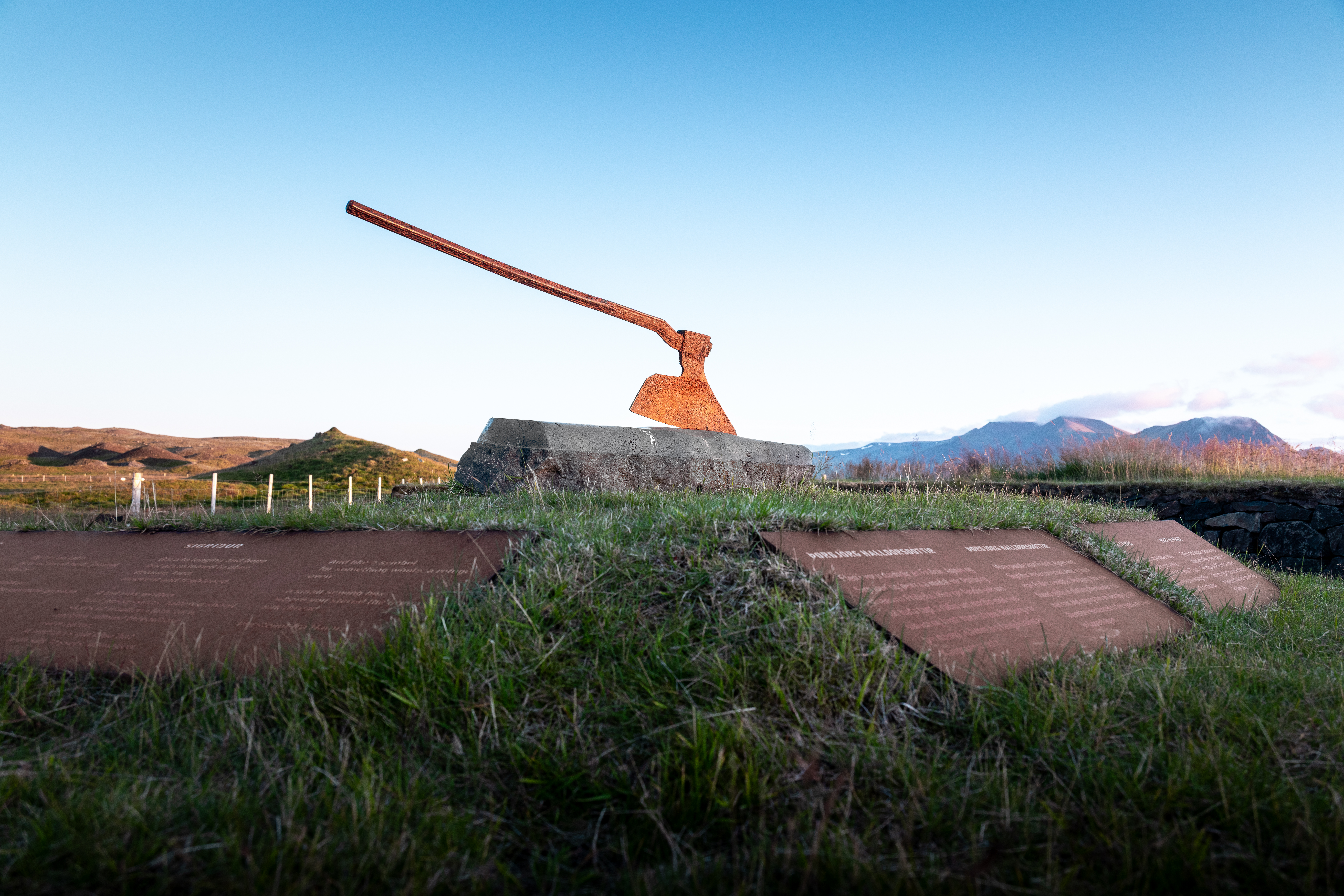 Þrístapar, the site of Iceland’s last execution in 1830
Hvítserkur
Day 2: Blönduós to Sauðárkrókur via Skagaströnd
Enjoy the coastal drive towards Skagafjörður and make time for a stop in Skagaströnd, a fishing village beneath Spákonufell mountain. Walk the marked trails around Spákonufellshöfði, explore the colourful harbour or see the coastline from the water on a guided kayaking tour. You can also discover the town’s folklore, creative community and local food before continuing your journey
If the weather allows, follow Route 745 around the Skagi Peninsula. Two highlights along this stretch are:
- Kálfshamarsvík – basalt columns, a lighthouse and the ruins of a former settlement by the shore.
- Grettislaug – a historic geothermal pool linked to the Saga of Grettir, with views towards Drangey island
Cap off the day in Sauðárkrókur, the largest town in Skagafjörður. Take a walk along the waterfront, learn about the region’s history or settle in for dinner at one of the town’s restaurants before spending the night.
Winter note: Route 745 may be closed or difficult to travel in winter. Check conditions before setting out. When snow conditions allow, the nearby Tindastóll ski area offers slopes for both beginners and experienced skiers, along with equipment rental.
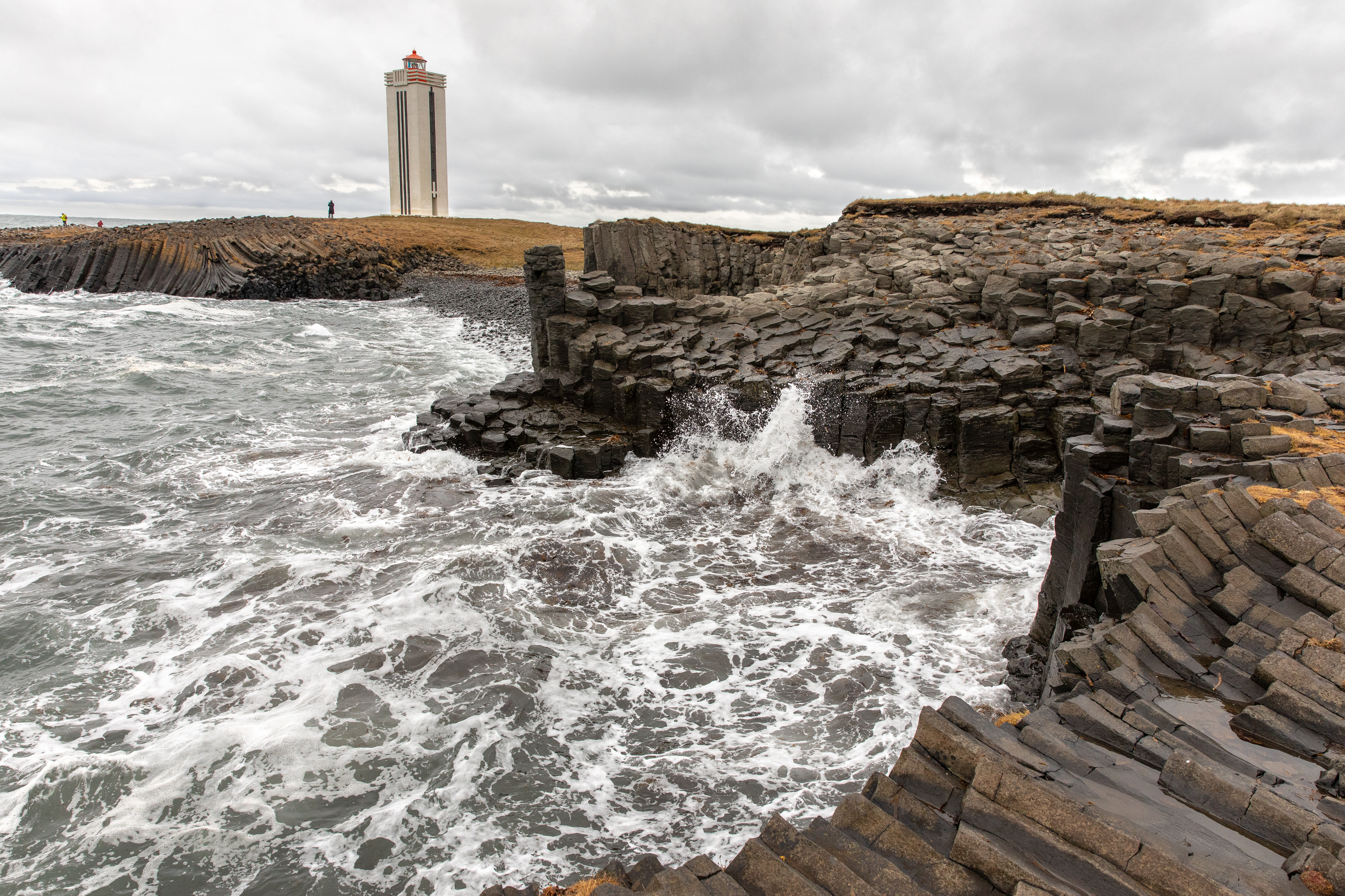 Kálfshamarsvík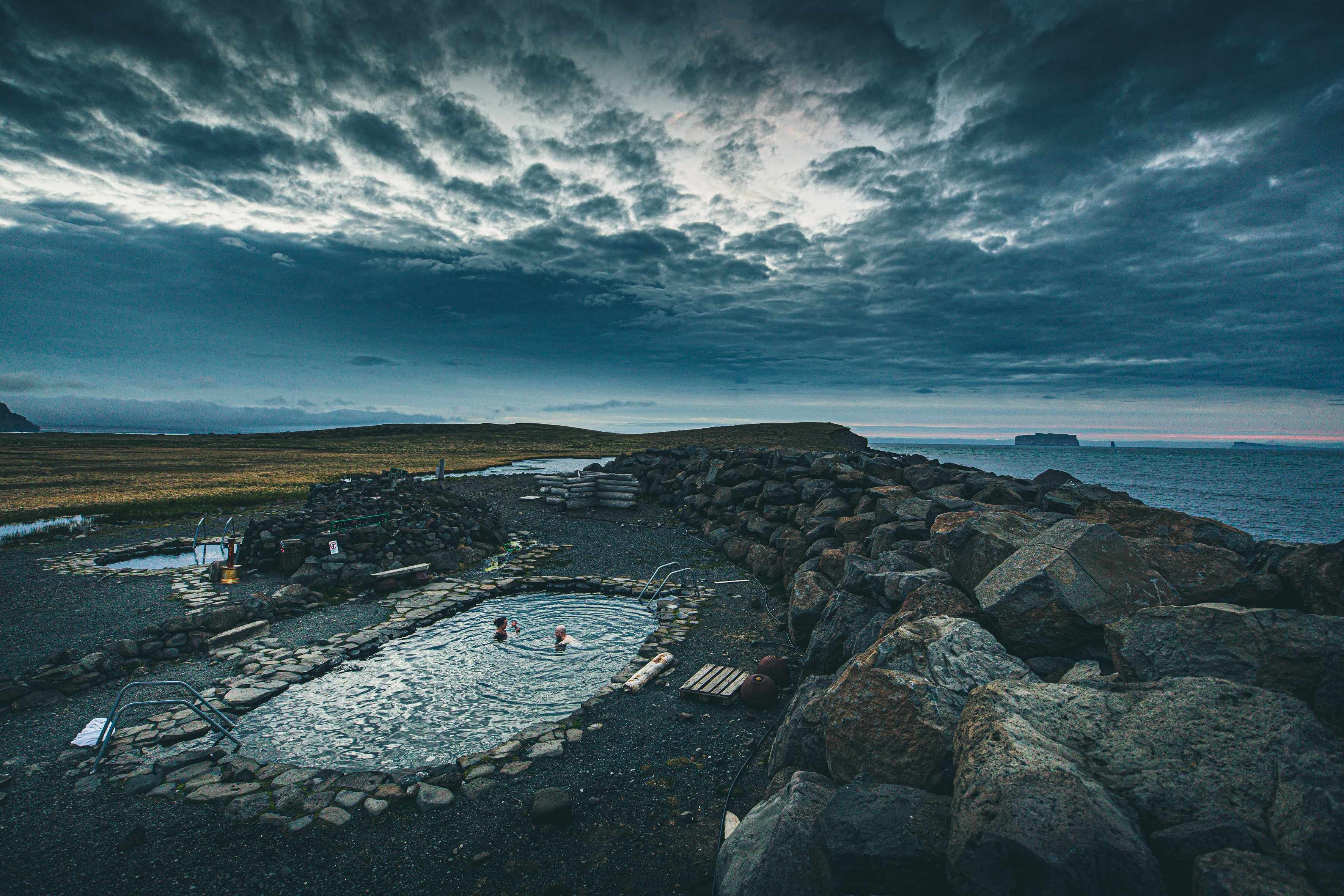
Grettislaug
Day 3: Exploring Skagafjörður
Spend the morning exploring Sauðárkrókur and the coastline of Skagafjörður. The town offers an interesting introduction to the region’s history, while nearby beaches provide wide views across the fjord towards Drangey island. During summer, you can also join a boat tour to the island to see its steep cliffs and abundant birdlife, including puffins.
Skagafjörður has a long tradition of horse breeding and is often described as the heartland of the Icelandic horse. Exploring the region on horseback offers a different perspective on the landscape, with tours available for both beginners and experienced riders.
Continue towards Hofsós, stopping at Grafarkirkja, one of Iceland’s oldest turf churches and a peaceful detour along the way. Spend some time exploring the village and its links to Icelandic emigration before ending the day in the swimming pool overlooking Skagafjörður. Stay overnight in Hofsós.
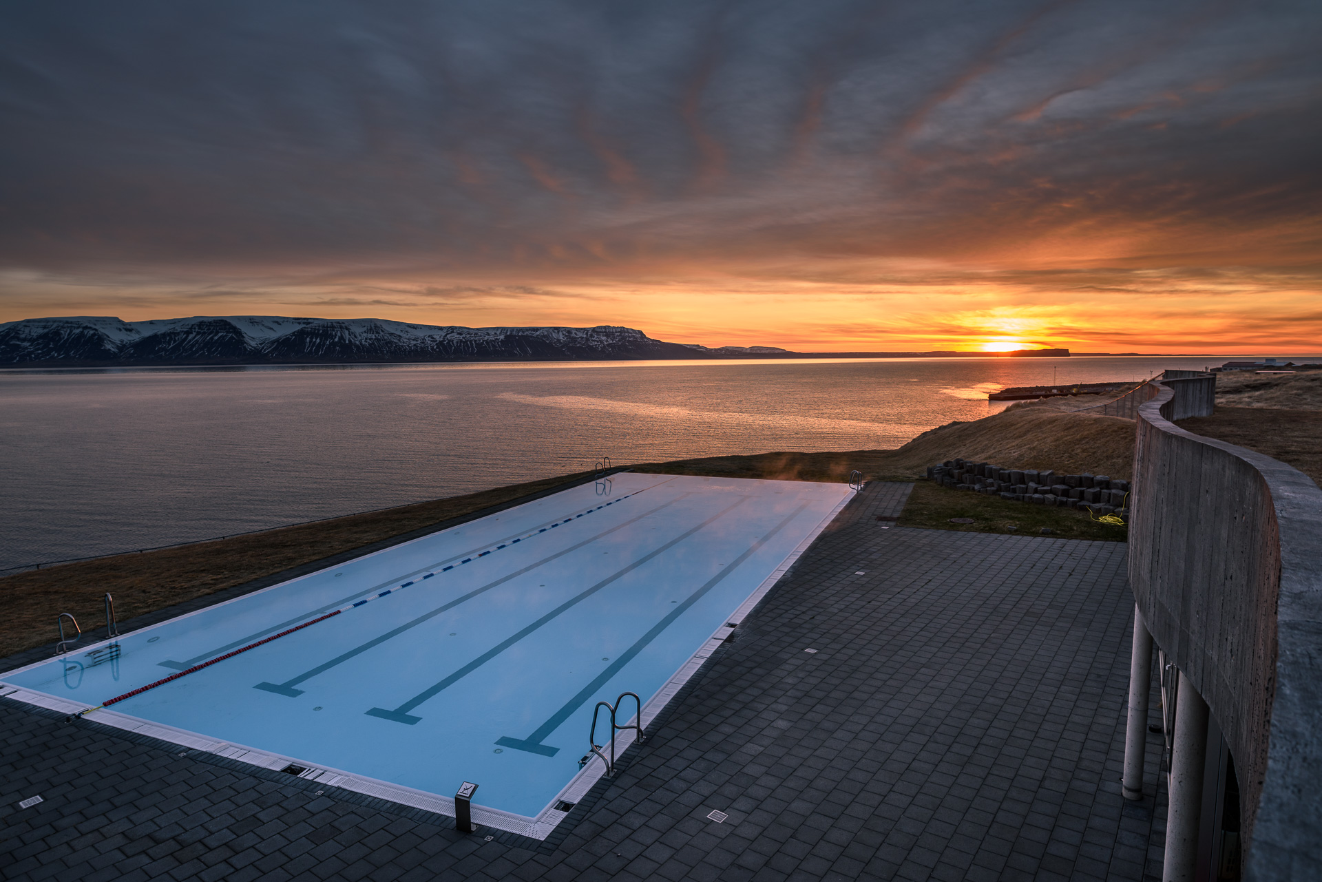
Hofsós Swimming Pool
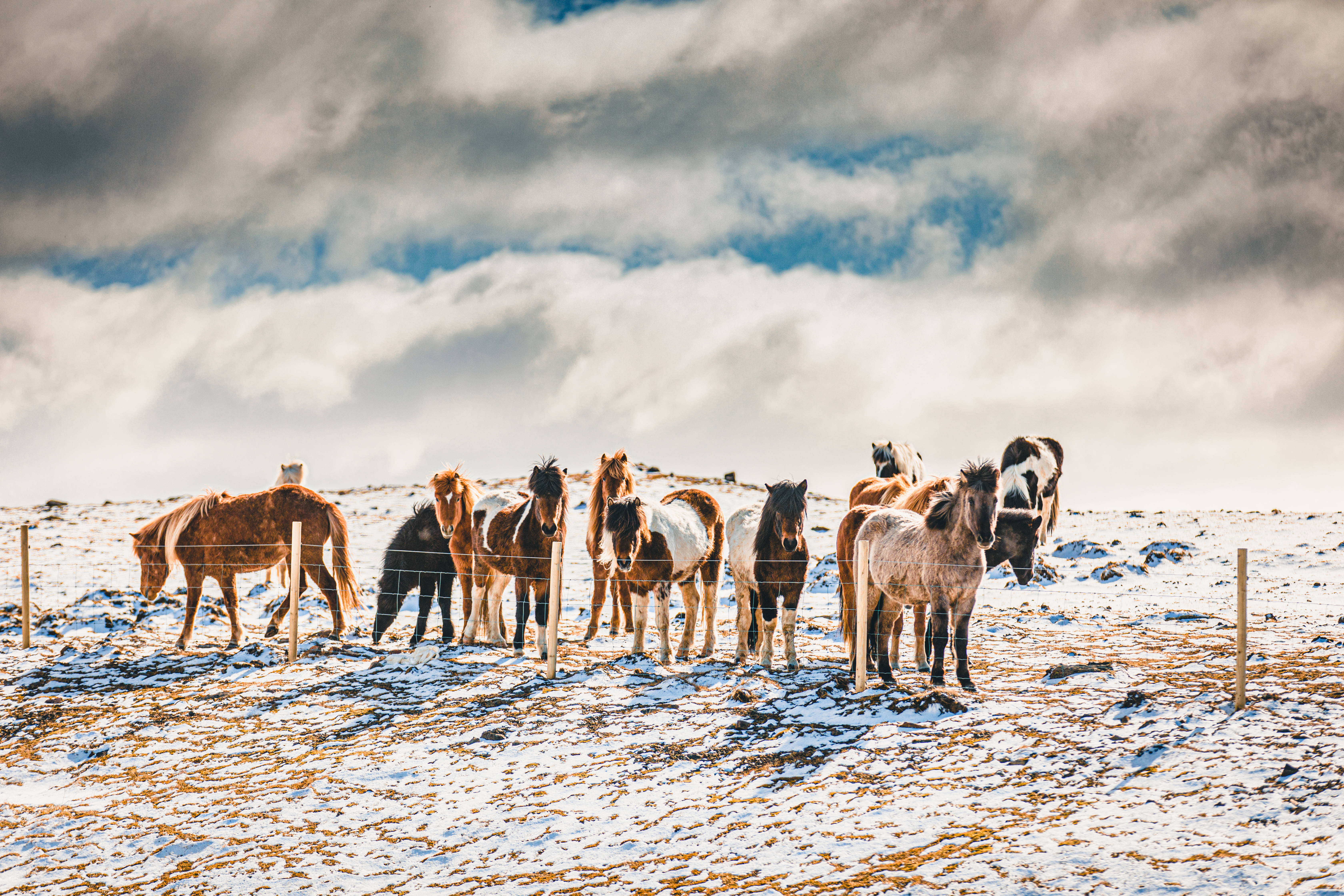
Skagafjörður is known as the heartland of the Icelandic horse
Day 4: Hofsós to Siglufjörður via Tröllaskagi
Leaving Hofsós, follow the coastline north as the open farmland of Skagafjörður gradually gives way to the steeper mountains and narrow valleys of the Tröllaskagi Peninsula. The route passes quiet farming communities, coastal viewpoints and the lakes and wetlands of Fljót before continuing through the mountain tunnel to Siglufjörður.
Along the way, consider stopping at:
- Brúnastaðir – a family-run farm where visitors can meet Icelandic farm animals and browse locally made products.
- Sauðanesviti lighthouse – a historic lighthouse just outside Siglufjörður, offering coastal views and a glimpse into the area’s maritime history.
Siglufjörður sits at the end of a narrow fjord and has a rich fishing history. Once the centre of Iceland’s herring industry, it now combines its fishing heritage with a lively cultural scene, galleries and restaurants. Explore the harbour and town centre before settling in for the night. In winter, the nearby ski area offers slopes overlooking the fjord.
Winter note: Strong winds and snow can affect travel through Tröllaskagi, so check road and weather conditions before setting out. On clear nights, the area around Siglufjörður can also offer excellent Northern Lights viewing.
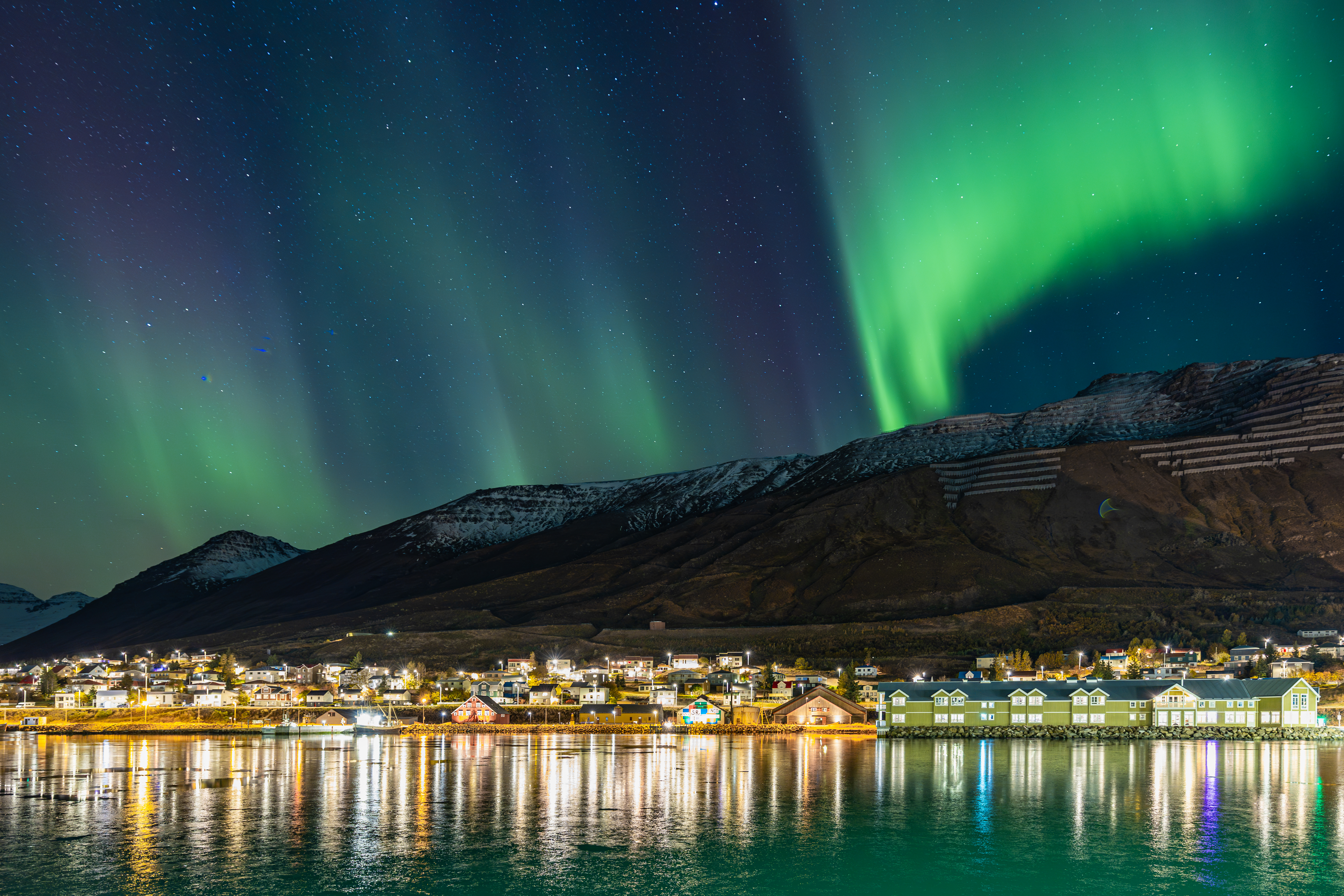 Northern Lights above Siglufjörður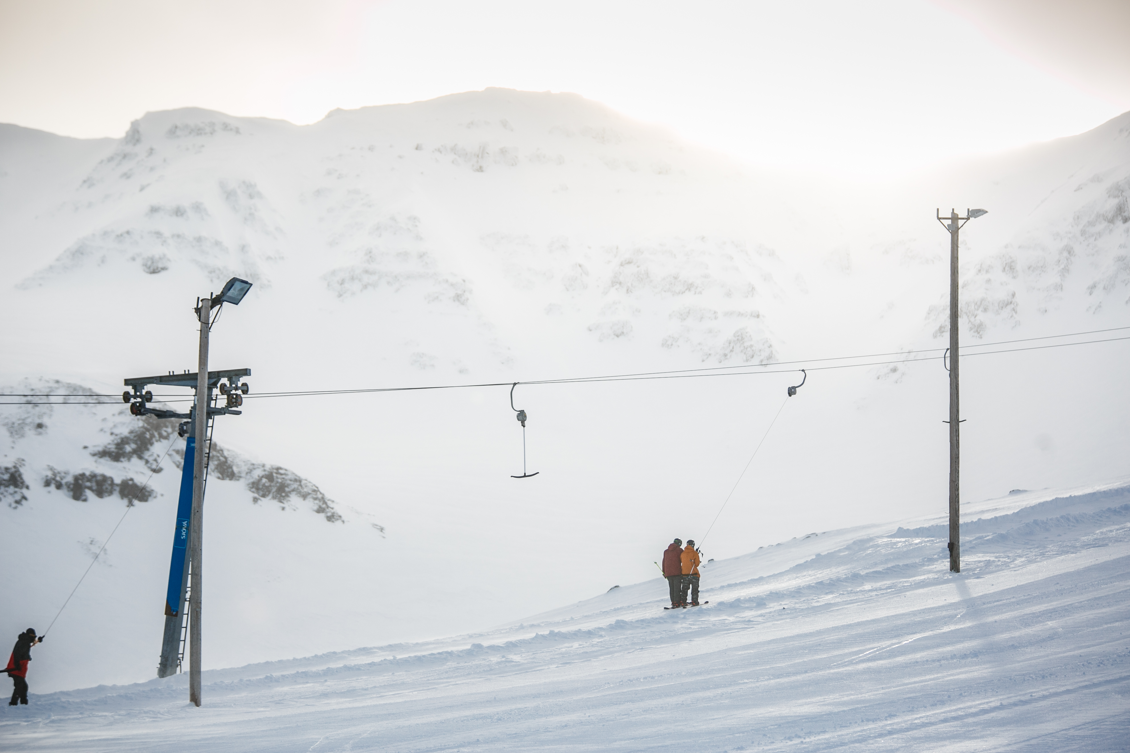
Siglufjörður Ski Area
Day 5: Coastal Villages of Eyjafjörður
This shorter driving day takes you through a series of small coastal communities along Eyjafjörður, with plenty of time to stop and explore.
- Ólafsfjörður – take a walk around this peaceful town, set between the mountains, sea and Ólafsfjarðarvatn lake.
- Dalvík – explore the harbour and stop for coffee or lunch. In winter, the nearby ski area offers runs for different ability levels.
- Hauganes – relax in the hot tubs by the black-sand beach and enjoy a meal overlooking the harbour.
- Árskógssandur – learn about Icelandic craft brewing on a brewery tour or catch the ferry to Hrísey island.
Ólafsfjörður, Dalvík and Akureyri all have excellent local swimming pools, offering an easy and affordable way to relax along the route.
Whale-watching tours also depart from Dalvík, Hauganes, Árskógssandur and Akureyri, giving you several options for heading out in search of whales and other marine life in Eyjafjörður.
Continue south along the fjord and end the day in Akureyri, where you will find a wide choice of restaurants, cafés, bars and accommodation.
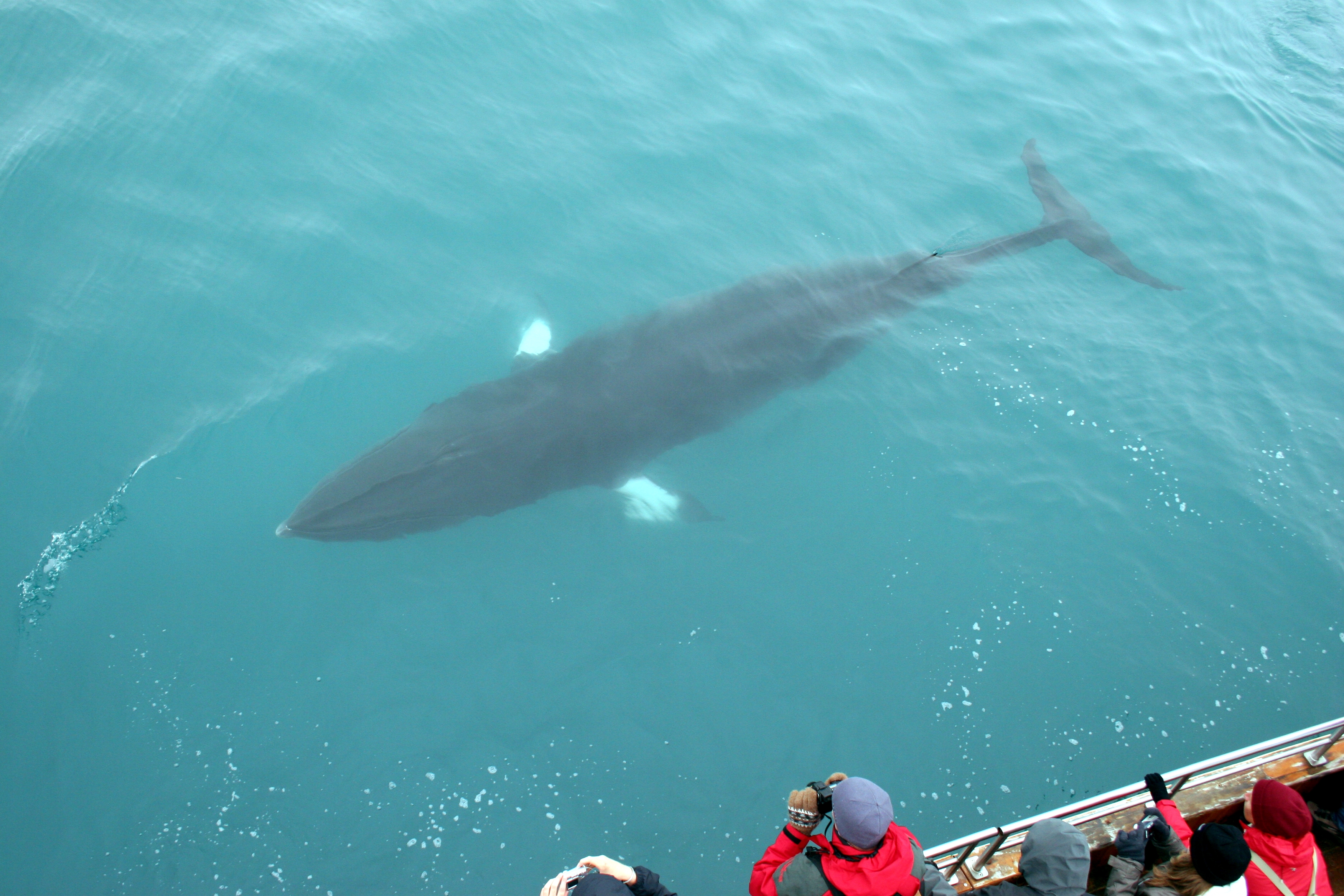
Whale Watching in Eyjafjörður
Day 6: Akureyri to Húsavík via the Diamond Circle
Start the day in Akureyri, the lively cultural hub of North Iceland. Take a walk through the town centre and old town, visit the church or explore the Botanical Garden before enjoying breakfast or coffee at one of the town’s cafés. The town also offers a wide range of museums, outdoor activities and geothermal bathing experiences if you want to spend more time exploring.
From Akureyri, follow the eastern shore of Eyjafjörður towards Húsavík. Along the way, explore fishing villages, coastal scenery and historic sites:
- Svalbarðseyri – follow the short coastal walk to the village lighthouse, with open views across Eyjafjörður towards Akureyri.
- Laufás – explore one of North Iceland’s best-known heritage sites, where traditional turf houses and a historic church offer a glimpse into life at a prosperous 19th-century vicarage. The museum is open during summer.
- Grenivík – stop for lunch, explore the harbour or take a walk up Þengilhöfði for views across Eyjafjörður.
Several museums and heritage sites can also be found along this stretch, offering an opportunity to learn more about the art, fishing traditions and rural history of the area.
Drive east to Goðafoss, a wide and powerful waterfall about 45 minutes from Akureyri. Walking paths on both sides of the river lead to several viewpoints.
End the day in Húsavík, where you can walk around the harbour, choose from several restaurants and cafés or relax in geothermal seawater overlooking Skjálfandi Bay.
Goðafoss
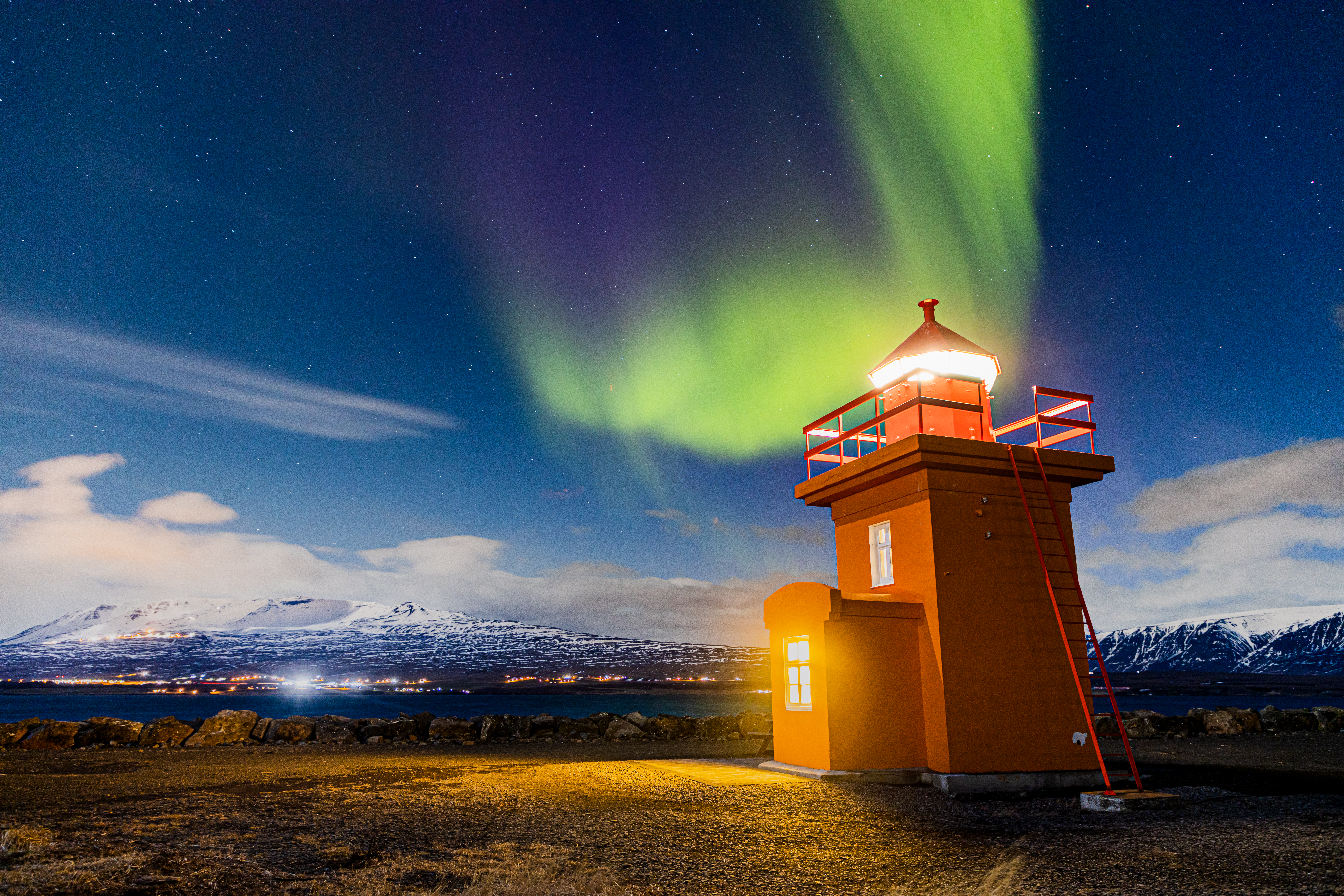
Northern Lights over Svalbarðseyri Lighthouse
Day 7: Húsavík to Kópasker
Known as Iceland’s Whale Watching Capital, Húsavík is an ideal place to join a whale-watching tour and explore the rich marine life of Skjálfandi Bay.
From Húsavík, follow the coast around the Tjörnes Peninsula, where the route becomes quieter and the landscape opens towards the sea. Along the way, you will find fossil beds at Tungulending, dramatic coastal cliffs and nesting seabirds during summer.
Highlights along this stretch include:
- Hringsbjarg – stop at the observation deck for views across Öxarfjörður and the nearby black-sand coastline. In summer, look out for puffins and other seabirds nesting along the cliffs.
- Fjallahöfn Beach – stretch your legs with a walk along the long black-sand beach and enjoy the open views across Öxarfjörður. Please park in the designated area rather than driving onto the beach.
- Ásbyrgi – explore the horseshoe-shaped canyon and follow the easy trail through the forest to Botnstjörn pond.
End the day in Kópasker, a small village on the shore of Öxarfjörður. Take an evening walk towards the lighthouse, look out for seals and birdlife along the coast and spend the night in the village.
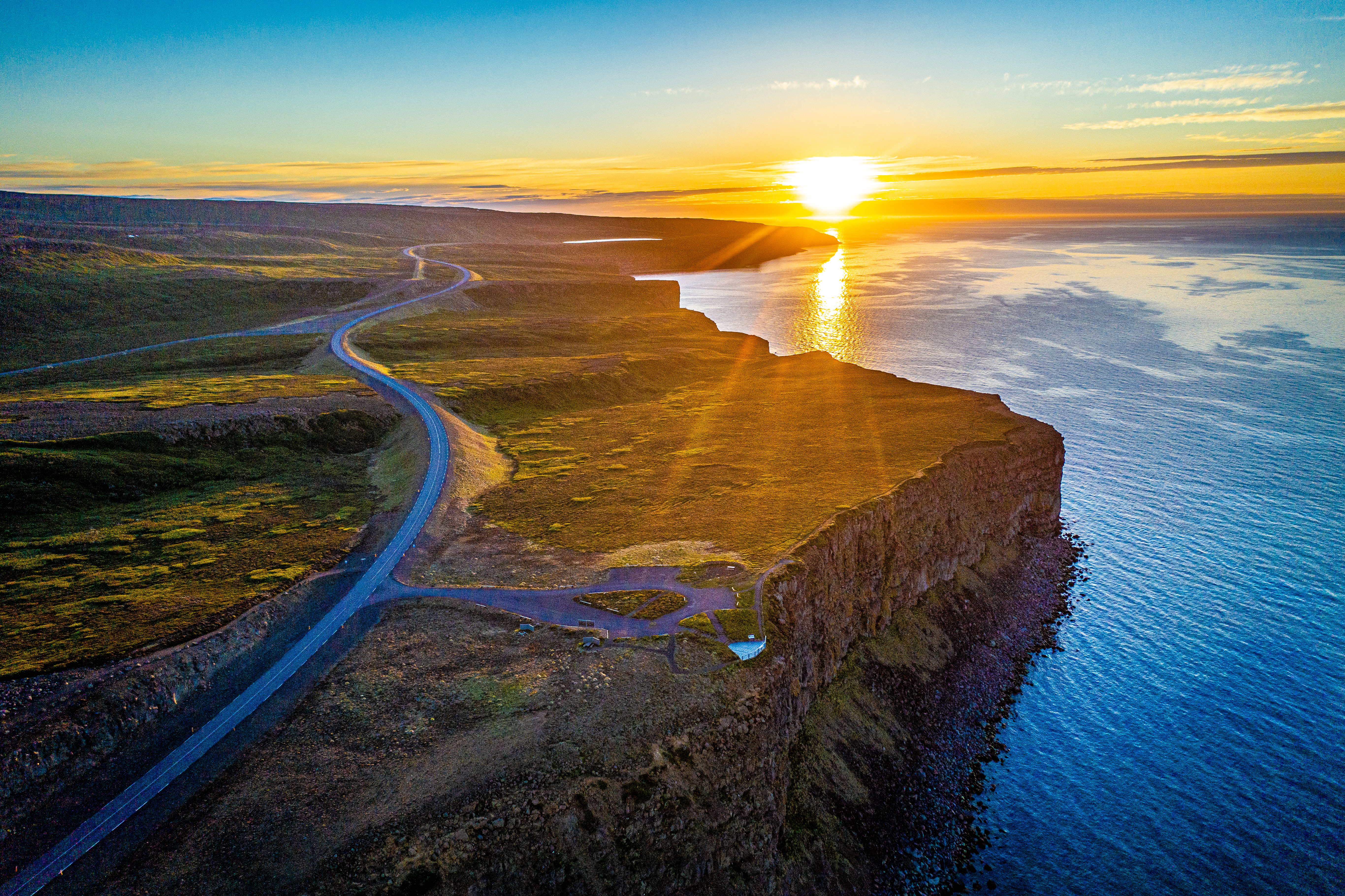
The road to Hringsbjarg under the midnight sun
Ásbyrgi Canyon
Day 8: Kópasker to Raufarhöfn
From Kópasker, the Arctic Coast Way continues around the remote Melrakkaslétta Peninsula along gravel Road 870. Deserted farms and open coastal landscapes characterise the route, so allow plenty of time for the drive. During winter or in difficult conditions, the more direct route to Raufarhöfn may be a better option.
Highlights around Melrakkaslétta include:
- Snartarstaðanúpur – a 6 km return hike to a 284-metre summit with expansive coastal views and, in clear weather, views as far as Grímsey.
- Hestfall and Hvalsvík – unusual coastal rock formations reached by a short walk from the road. This is a summer destination, and care should be taken near the steep cliffs and powerful waves.
- Hraunhafnartangi – an easy walk leads to the lighthouse at the northernmost point of mainland Iceland, close to the Arctic Circle.
Finish the day in Raufarhöfn, Iceland’s northernmost village, where summer nights are exceptionally bright and winter days remarkably dark. On the hill above the village, the Arctic Henge brings together Icelandic culture, literary history and astronomy in a striking outdoor artwork. Spend the night in Raufarhöfn.
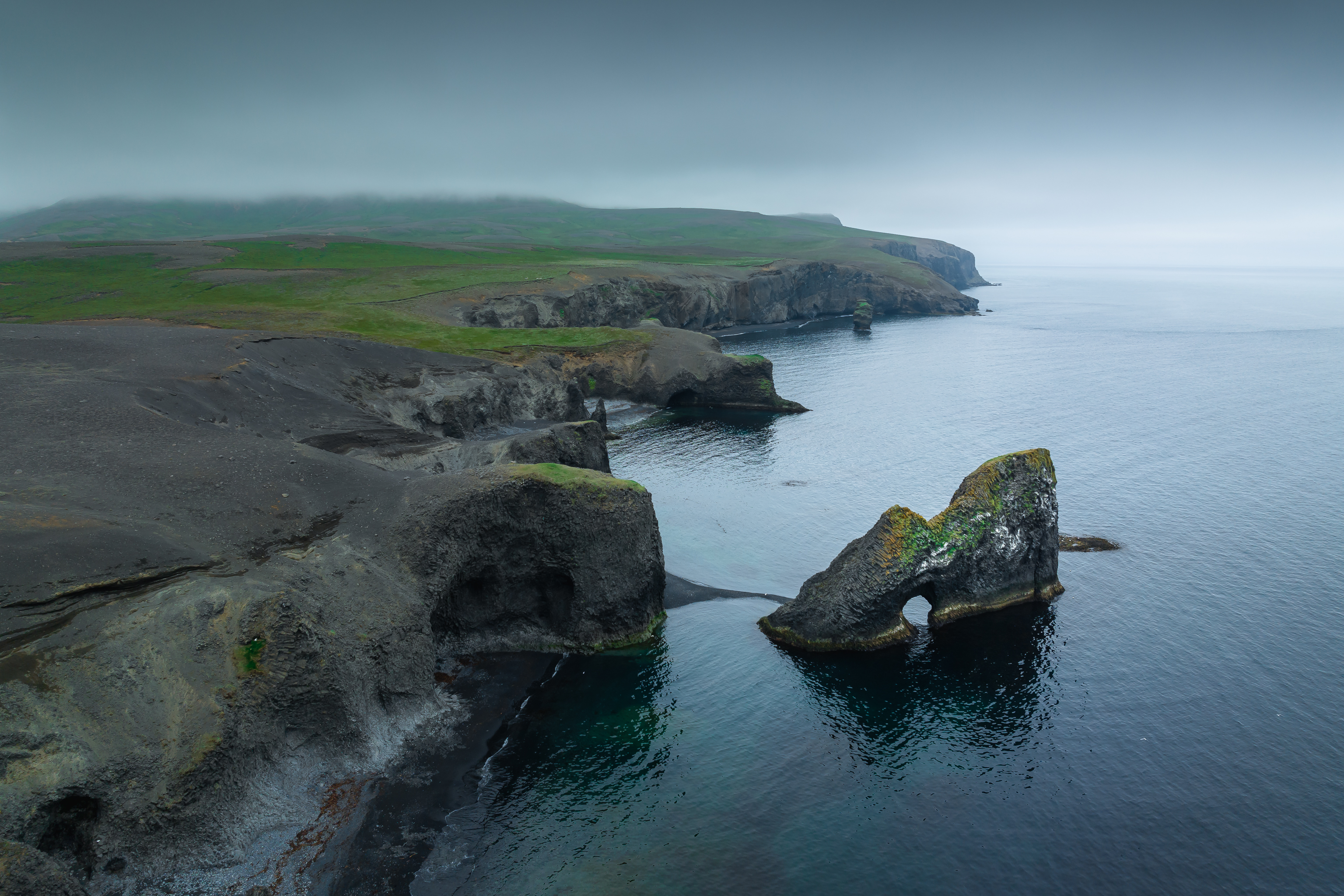
Hestfall rock formations at Hvalsvík
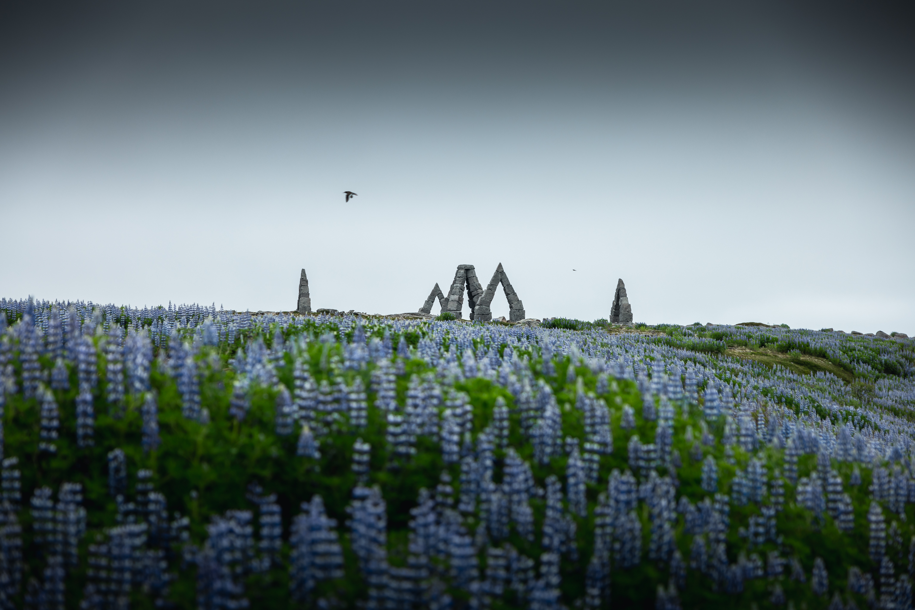
Arctic Henge
Day 9: Raufarhöfn to Vopnafjörður via Langanes
Travel south from Raufarhöfn to Þórshöfn, where you can refuel and stock up before exploring the more remote parts of the route.
In summer, allow several extra hours for a detour onto the Langanes Peninsula. The rough gravel roads are best suited to a suitable 4WD vehicle, and highlights include:
- Stóri Karl – a sea stack home to Iceland’s second-largest Northern Gannet colony, viewed from a platform extending over the cliffs at Skoruvíkurbjarg.
- Fontur Lighthouse – a remote lighthouse at the eastern tip of Langanes, surrounded by dramatic cliffs, open ocean and nesting seabirds.
- Skálar – the remains of a once-thriving fishing village that was abandoned in the 1950s. Numbered markers identify several of the former buildings.
Return to Þórshöfn and continue towards Bakkafjörður. Near the village, Draugafoss waterfall is reached by an easy marked trail from the turn-off to Dalhús. The walk takes around 30–60 minutes and is open throughout the year, although accessibility always depends on current conditions.
Continue towards Vopnafjörður for the night.
Winter note: Road to Langanes Peninsula is unmaintained in winter. Focus instead on Þórshöfn and Bakkafjörður, with shorter drives and easier access.
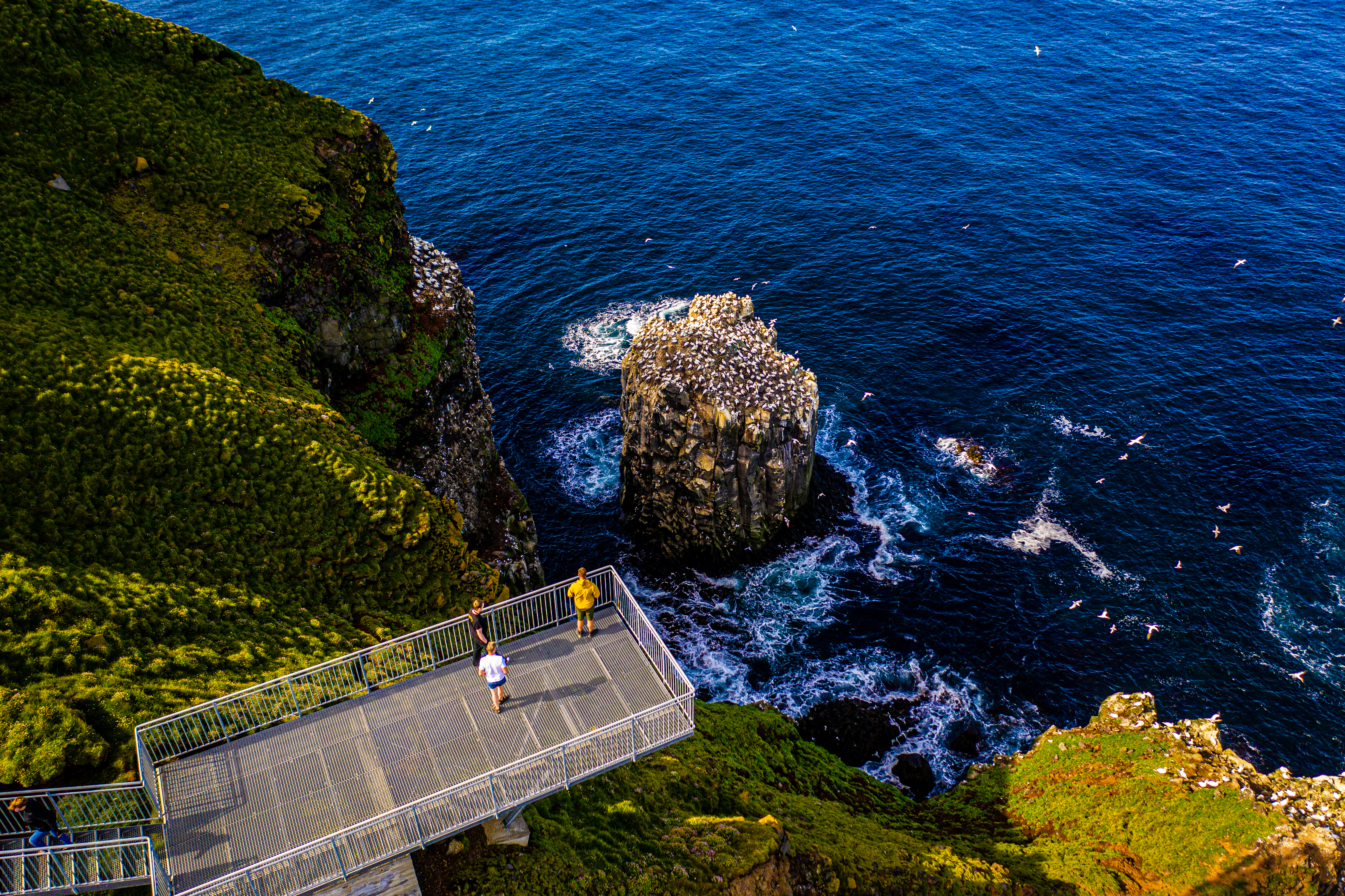 Stóri Karl Sea Stack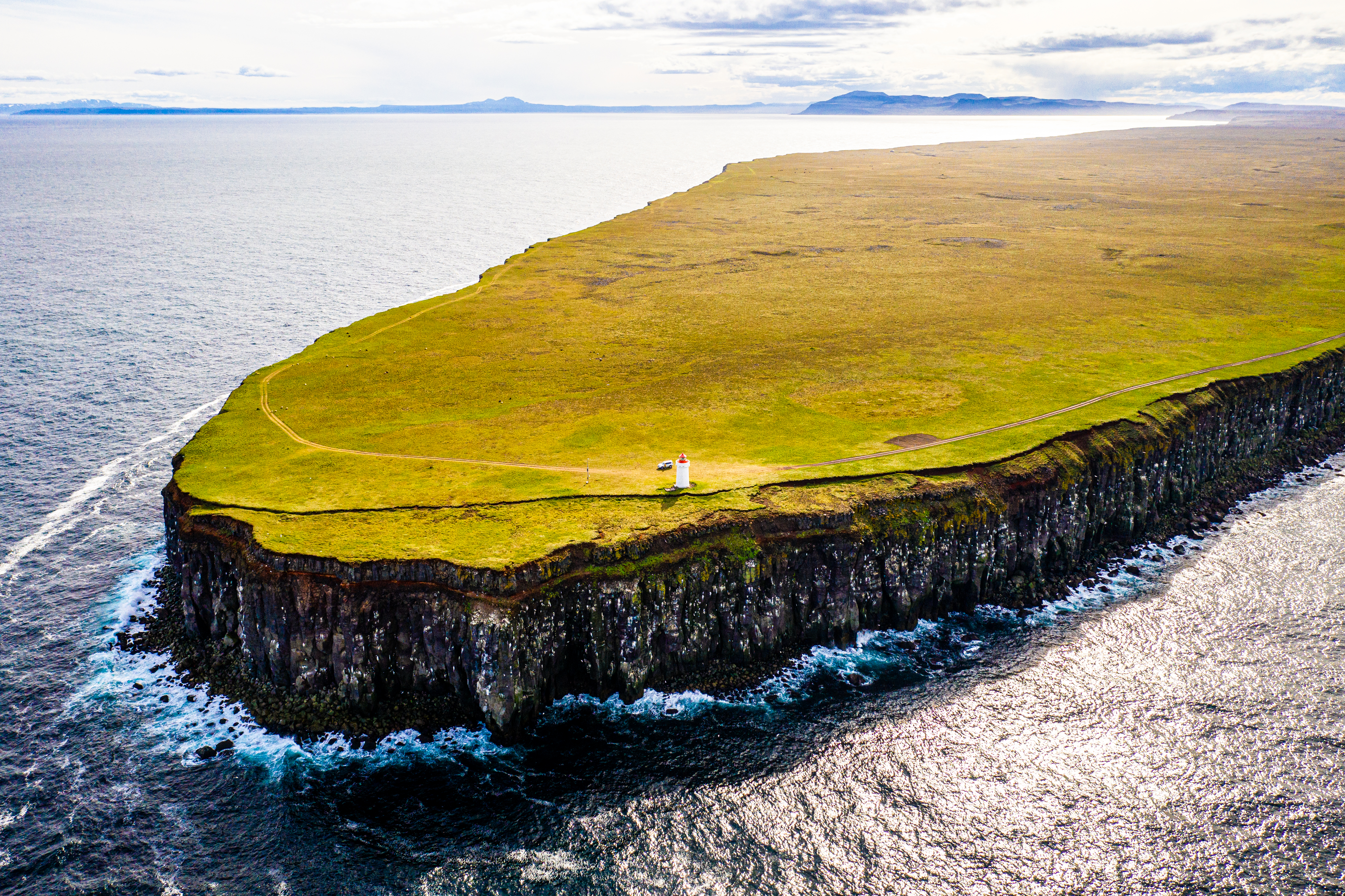
Fontur Lighthouse at the tip of the Langanes Peninsula
Essential Travel Tips for Arctic Coast Way Drive
Before you start your 900 km journey, stretching from Hvammstangi in the west to Bakkafjörður in the east. Remember these important safety and sustainability tips to help your trip go smoothly:
- Plan your time: Driving the entire route takes around nine days at a relaxed pace. Outside summer, keep your itinerary flexible and allow extra time for changing weather, road closures and limited access to some sections.
- Drive with care: About one-third of the route is gravel. A 2WD car is fine, but a 4x4 vehicle is recommended. Drive slowly, especially when moving from paved roads onto gravel, and use the blue M meeting points to let oncoming traffic pass safely.
- Winter safety: Snow and winter conditions can occur between September and May, and severe weather may temporarily close even regularly maintained roads. Check umferdin.is, vedur.is and safetravel.is before setting out.
- Stay on the road: Off-road driving is illegal and can cause lasting damage to fragile vegetation. Stop only in safe, designated areas when taking photographs or enjoying the view.
- Camp responsibly: Camper vans, caravans and similar vehicles must stay at organised campsites unless permission has been granted by the landowner or rights holder. Camping rules for traditional tents vary according to location, so check the official guidance before your trip.
- Leave nature as you found it: Stay on marked trails, respect closures and take all rubbish with you. Icelandic plants and mosses recover slowly, and even fruit peels take a long time to break down in the cold climate.
- Respect wildlife: Observe animals quietly and never feed them or move between adults and their young. Keep at least 50 metres from resting seals and 100 metres away during pupping, weaning and moulting periods. In spring, watch carefully for ground-nesting birds and avoid flash photography near wildlife.
Completing Your Arctic Coast Way Journey
Following the Arctic Coast Way takes you through fishing villages, quiet harbours, striking rock formations and some of North Iceland’s most remote coastal landscapes.
The route changes completely with the seasons. Summer brings long, bright days and rich birdlife, while winter transforms the coast with snow, northern lights and a slower rhythm. Whichever season you choose, the journey offers a closer connection to the landscapes, communities and stories that shape North Iceland.
Explore the route, find places to stay and start planning your journey at arcticcoastway.is.
Frequently Asked Questions About Arctic Coast Way
What is the best time of year to drive the Arctic Coast Way?
There is no single best time, as each season offers a different experience. Summer brings long daylight hours, abundant birdlife and access to the full route, including its more remote coastal sections. In winter, travellers can follow the dedicated winter route, which uses regularly cleared roads and alternative connections where access is limited. Snowy landscapes, northern lights and quieter villages give the journey a completely different character.
Can I drive the Arctic Coast Way in winter?
Yes. A dedicated winter route connects the communities along the Arctic Coast Way using roads that receive regular snow clearing and alternative roads where necessary. Some remote coastal sections have limited access, so always follow the winter map on Arctic Coast Way website and check current road and weather conditions before travelling.
Do I need a 4x4 vehicle?
A 4x4 is strongly recommended. Around one-third of the route is gravel, and some of the more remote peninsulas have narrow or rough roads. A suitable vehicle provides better stability and greater flexibility, particularly when conditions change.
Are fuel and food readily available along the route?
Services are available in towns and villages, but distances between them can be considerable and opening hours may be limited, especially outside summer. Fill up when you have the opportunity and keep some food and water in the car.
Can I see the Northern Lights along the Arctic Coast Way?
Yes. The route passes through sparsely populated areas with little light pollution, creating good conditions for aurora viewing when the sky is dark and clear. Northern Lights may be visible from late August into April, but sightings are never guaranteed.
Is the Arctic Coast Way safe for solo travelers?
Absolutely, Iceland is consistently ranked among the safest countries in the world. Just make sure to check the weather and road conditions daily, as nature is the only real "hazard" you'll encounter.
How many days should I allow for the itinerary?
Allow around nine days to experience the full route, including the islands, at a comfortable pace. The Arctic Coast Way is best enjoyed slowly, with time for activities, longer stops and unexpected discoveries along the way. If you are travelling outside summer, keep your schedule flexible and consider allowing a few extra days in case weather or road conditions affect your plans.